At The Border - Ifor Duncan and Stefanos Levidis - Weaponizing a River

Weaponizing a River

Ifor Duncan and Stefanos Levidis

The river Ardas near its confluence with the Evros-Meriç in the  Karaağaç Triangle, February 2019. Photo: Ifor Duncan and Stefanos Levidis.

At The Border
April 2020

The Dam

On the 10th of March, news reports emerged suggesting that Bulgaria had released water downstream from the Ivaylovgrad Dam on the Ardas, a tributary of the Evros (also Meriç, and Maritsa),1 and flooded the river border at the request of the Greek government.2 This intentional flooding of the border was subsequently denounced as fake news by the Bulgarian authorities and remains unverified.3 Yet due to the increasing severity of spring floods, including as recently as 2018, the release of water from Bulgarian dams has been a subject of friction between Greece, Turkey, and their upstream riparian neighbor. On the 27th of February, Turkey decided to effectively suspend the 2016 EU-Turkey deal and in doing so directed thousands of asylum seekers to the border with Greece. In the context of Greece’s military response, the recent reports have revealed a hidden violence designed into the environment of the Evros river. In the weeks since, there have been two confirmed casualties from the use of either live or rubber rounds—Muhammad al Arab and Muhammad Gulzar.4 The alleged opening of the dam and these shootings are not distinct but are in continuity with the long-term, albeit previously low intensity, weaponization of the river. These exceptional events prove the more insidious use of the Evros as an ecological border infrastructure extending to its entire floodplain.

The intentional flooding of the valley, and its entanglement with border defense strategies, testifies to Evros as an arcifinious space. Derived from the legal heredity of international border law, according to legal scholar John W. Donaldson, the term “arcifinious” is the territorial concept whereby a state is bounded by geophysical limits with defensive capabilities, or “natural” boundaries “fit to keep the Enemy out,” such as seas, rivers, deserts, and mountains.5 According to eighteenth-century Dutch jurist Hugo Grotius and his followers, rivers are “part of ‘arcifinious’ or ‘natural’ military frontier zones that are ‘indetermined,’ and flexible based on the application of force.”6 While rivers shift of their own volition, they are also manipulated, like straightening. Perhaps more tellingly, the very flexibility of a river—its interstitial condition between water and sediment—is useful in the production of an “indeterminate” space that is materially porous, shifting, and thus difficult for trespassers to cross. This material ambiguity also makes river boundaries unstable in the eyes of international jurisprudence. The hostile characteristics of arcifinious boundaries are mobilized in naturalizing processes central to sovereign claims to territory in a practice that enables states to obscure their agency in relation to border deaths.7

Some days before the 10th, word had been circulating inside the Fylakio registration and pre-removal detention center in the north of the Evros region that the dam would be opened to make the river more difficult to cross. The dam being discussed by border guards as part of a border defense strategy emphasizes the river not as “natural” but, to the contrary, always flexible to force. Fylakio, also located near the Ardas river, would be one the first villages reached when onrushing water from the dam crosses the Bulgarian-Greek border. Before these waters arrive at the “Karaağaç Triangle,” the Ardas serves as the Greek-Turkey border for one kilometer, after which it meets the Evros/Meriç between the Greek villages of Marasia and Kastanies. This is the northwestern point of the Karaağaç Triangle, which was the only segment of the Greece-Turkey border not originally delimited by the Evros/Meriç river in the 1926 Athens Protocol, an annex to the 1923 Lausanne Peace Treaty. Instead, it is today a stretch of deforested land with an eleven-kilometer-long deterrent fence. Proposed in 2011 and completed in 2012, the fence directs border crossers to more dangerous routes across the river, and to deadlier maritime crossing routes in the Aegean sea. Fittingly, the fence is mentioned as a “technical obstacle” in FRONTEX Serious Incident Reports (SIR).8

The Karaağaç Triangle is where refugees were directed by the Turkish government on the 27th of February, and where they found themselves trapped between Greek forces who would not let them cross and Turkish forces who prevented them from returning to Istanbul and the Turkish mainland. It is where Muhamad Gulzar, a young man from Pakistan, was shot dead, and five more were injured on the 4th of March. During our visit to the Evros in early March, we witnessed trucks carrying fencing towards strategic—yet unfortified—parts of the river. The fence is currently being elongated by forty kilometers, particularly along parcels of Greek land that sit on the Turkish side of the river, and vice versa.9

In the war of words exchanged by the two sides, the Greek government and far right Twitter has been using the term “hybrid war” to describe what they perceive as a Turkish attempt to “intrude” on Greek territory through indirect means, here with refugee bodies instead of bullets. In response to Turkey’s weaponization of refugees, Greece and the EU are also employing a form of hybrid warfare explicitly incorporating the river ecology itself. Where so many people were—and still are—trapped in spaces along the frontier, like at Karaağaç, they are exposed to a hybrid form of border violence involving farmers spraying pesticides onto refugees across the fence,10 the deployment of large fans to direct teargas back to the Turkish side,11 and the use of water cannons to spray blue liquid across the fence so those who make it onto the Greek side can be easily identified.12 In addition to these assembled elements, on the night of the 26th of March, the impromptu camp that had been set up in Pazarkule, on the Turkish side of the border, caught fire. In videos that were circulated, witnesses claim that the fires were lit by Turkish authorities (jandarma) in their attempts to remove asylum seekers from the border (a measure supposed to counter the spread of COVID-19).13

Authors in critical border studies refer to the mobilization of geophysical and environmental features either as a hybrid collectif,14 an assemblage of actants,15 landscape as space of moral alibi,16 or what we call border natures. The border’s ecology of exception is made possible by both the river’s adaptability to force and flexibility, and contributes to the production of an ambiguous space in which multiple modes of violence are perpetrated with impunity. Methods of hybrid warfare are unambiguously mobilizing environmental elements. As such, “nature” can no longer be an alibi but is directly incorporated in the production of death at the border.

What is the role of water in the politics of death at the border? Here river waters stand at the intersection of connection-division, and life-death.17 The fluvial frontier is a complex and nuanced territorial condition braiding together multiple elements including conservation, transboundary river management, military technology, the geopolitics of resource logistics,18 and the divergently visible and opaque politics of border crossing. Thinking against material and discursive reproductions of both rivers and borders as “natural” phenomena, the Evros/Meriç/Maritsa river is the result of multiple organizational technologies of territorial sovereignty. Primary amongst these is the mobilization of major infrastructure: the dam and the contingent release of waters downstream would be a direct threat to the lives of asylum seekers attempting to enter the EU. If Bulgaria, as a member state, had opened the dam, this would have been premised on its contribution to the fortification of the external borders of fortress Europe.

Border demarcation Pyramids, Types I, II, III, IV. Source: I. Dimitrakopoulos, Ta Chersaia Synora Tis Elladas (The Land Borders of Greece), PhD Submission, Aristotle University, Thessaloniki, 1986.


2. A Shifting Border

The Evros/Meriç/Maritsa has its source in the Rila mountains. It runs for 310 of its 528 kilometers through Bulgaria, with the final 210 kilometers forming a border, initially between Bulgaria and Greece, and then for the last 192 kilometers between Greece and Turkey before reaching its delta and emptying into the Thracian Sea in the Aegean. The river is fast, with a mean annual flow rate of 103 cubic meters per second (a rate which can increase twofold between December and April). Its course flows over sandy and malleable soil, and annually discharges approximately 3.2 million tons of sediment and 9.5 billion cubic meters of freshwater into the sea.19 This results in frequent erosion that alters its banks. Capricious shifts of the river produce islands of stranded land; there are expanses of “Turkish” earth on the “wrong” side of the river, and elsewhere, land has been ceded by the river to Greece. These stranded territories are also points where fatalities become concentrated. Pavlos Pavlidis, coroner at the University Hospital of Alexandroupolis, capital of the Evros prefecture, and Maria-Valeria Karakasi have identified a particular parcel of land near Feres, the entry point to the Delta, as the location where seventy-two bodies were recovered between 2000 and 2014. This is also where refugees were recently directed by geographers aligned with Turkish authorities,20 and where a young man from Aleppo, Muhammad al Arab, was shot dead by Greek soldiers standing inside the dry river bed of the 1926 border, which now acts as little more than a trench. Within the above calculations of river flow and sediment transportation is concealed a deadly politics of bordering that incorporates the full spectrum of the Evros’s hydrology and manipulates the ambiguities produced by rivers.

The river’s movements occupy a central role in the territorial disputes between the riparian states of Bulgaria, Greece, and Turkey, and compound what is already a militarized terrain. Due to these shifts, and the river’s own agency, many have considered rivers as inadequate political boundaries. Donaldson words it thus: “the presence of water makes a boundary river unstable, forceful, and risky; incompatible with the legal fiction of a fixed boundary line that would prefer the stability of land over the dynamism of water.”21 This instability lies behind the fantasies of territorial control implied by the international committee assembled in 1926 with the task of determining the precise course of the border between Greece and Turkey at the end of the Ottoman Empire.22

The 1926 committee, headed by Dutch colonel J. Backer, deemed that the border follow the median line between the banks throughout the course of the river, or its main “branch,” when the river splits. The border was marked with red ink on ten maps that were attached as annexes to the protocol, and the first twenty-six demarcation “pyramids” were installed.23 Delimited in such an inflexible way, like many river borders, it could not respond to shifts in the median line and changes in the course of the river. Instead, the demarcation of the protocol fixed the river in time and to an abstract line. Consequently, efforts to enforce the demarcation of the border have long been hampered by the agency of the river itself. As early as 1965, markers installed to designate part of the border along the Evros/Meriç by a joint Greek-Turkish committee were quickly carried away by the river. Similarly, in 2015, parts of the fence were carried away by flood waters released from the Ivaylovgrad dam.24 As recently as October 2017, Turkish authorities dug trenches underneath the fence to prevent flooding.25

A flooding border, 2015–2019. Source: Google Earth


There is now almost 100 years of geomorphological variation between the drawn border and the current course of the river. Islands that used to be there are no longer; banks have moved and canalizations have directed the river in divergent ways. Two rivers and two borders exist at the Evros/Meriç: the cartographic border of the old median line (featuring now almost unmoving oxbow lakes) and the water of the new trespass line. It comes with little surprise then that stabilizing the river banks to the 1926 condition has been a concern of both Greece and Turkey. Since 1936, the two countries have made efforts to draft plans for common flood defense, most notably the study undertaken in 1953 by the Chicago-based Harza Engineering Company. None of these plans were fully implemented, and after the 1970s, bilateral communication ceased for decades.

In addition to the proposal of the fence in 2011, the Hellenic Army General Staff planned an unfulfilled project to dig a “120-kilometer-long, thirty-meter-wide, and seven-meter-deep” “moat.”26 Officially an “anti-tank trap” functioning primarily as a defense against Turkish invasion, in the context of increased crossings in 2011, the “moat” would have only been a further technical barrier for border crossers.

Where rivers appear at first glance as “natural,” they are, to greater and lesser extents, the result of centuries of small and large-scale engineering interventions. In Stefan Helmreich’s concept of “infranature,” second nature—that which is always produced as socio-technical—is “folded” back into first or organic nature.27 What appears as “natural” or “organic” is therefore actually a mask for the production of techno-natural infrastructures. Helmreich echoes a famous passage in Michel Serres’s The Natural Contract where he describes the birth of geometry emerging from the calculations of Nile floods. Out of the “chaos” and “disorder” of flood events, Serres proposes that measurements made by surveyors, for irrigation purposes, reordered nature to give “it a new birth into culture.”28 Such culture, however, may itself produce violent effects. The measurements that reorder the river waters of the Evros are born into a culture that takes the form of a hybrid military-natural assemblage.

Understanding the often intentionally ambiguous calculations of infranature in its combative applications helps to clarify how rivers are technologized through overt human interventions, such as dams and other large engineering projects, as well as in less overt ways. Rivers and their flows respond to assemblages of smaller scale and almost invisible interventions or those that occur far up river, like the opening of a dam. In these ways, the very speed at which water travels, or the amount of sediment that accumulates in the muddy delta, are part of the measurements of the infrantural technology of the arcifinious river. In these border environments, the river itself is potentially armed and dangerous.

The river and its imagined doubling as a moat instrumentalizes the already treacherous route for asylum seekers beyond the scale of a “deterrent” into an engineered space unconcerned with fatalities. Stepping back from the Hellenic Army General Staff’s imagination, the Evros already performs the arcifinious role of a moat at the EU’s fluvial frontier. The drawing of a fixed, yet imaginary line along the central course of the river effectively produced the river as a frontier, whereby its movements and muds become spaces where sovereign territorial imaginaries are projected with horrifyingly real effects.

A map of proposed flood-defense works produced in 1953 by the Harza Engineering Company. Source: Chouvardas and Papapostolou, “River Floods and Crossborder Cooperation” (2016).

3. Flood

The risk of major flood events has long been one of the primary transboundary concerns in the Evros/Meriç/Maritsa. Such events have increased in frequency over the last twenty-five years, leading to a once in a thousand-year flood in 2005, severe events in 2006, 2007, 2011, 2014, and 2015, and a “state of emergency” announced by the Greek Government in March and April 2018.29 Flooding in the region is closely tied to the politics of hydro-electric infrastructure. The majority of large dams and reservoirs in the basin are concentrated on Bulgarian territory (as many as 722),30 while Turkey has built sixty,31 and Greece just five (mainly for irrigation purposes, as opposed to energy production).32 Flow variability is central to many transboundary agreements whereby upstream riparian nations either force or allow downstream riparians to adapt to seasonal changes in both wet and dry conditions.33 This is a concern for hyrdrodiplomatic relations between Greece, Turkey, and Bulgaria.

When a tri-lateral working group met in October 2006 in Alexandroupolis, Turkey made a written demand, supported by Greece, that the reservoir storage capacity of large dams situated on the Ardas tributary in Bulgaria be regulated to “minimize water discharges downstream and reduce flow at Edirne,” a densely populated area, near to the border fence, and a major confluence where the Ardas and another tributary, the Tundzha, meet the Evros/Meriç/Maritsa. The Bulgarian delegation refused to respond and cancelled future working groups. Bulgaria is resistant to such regulation because of the role that the private sector plays in managing hydro-electric infrastructure.34 To maximize energy productivity and profits, their primary interest is to maintain the highest possible water level in the dam reservoirs all year round. Under previous conditions, this would have been in direct opposition to the interests of the downstream nations who want to regulate reservoir storage in wet seasons so they have the capacity to accommodate potential increases in volume that risk overtopping dams and result in flooding.35 The events of the past month, however, show that within the context of Bulgaria’s entrance into the EU in 2007, upstream storage of high levels of water is also part of military contingency planning to flood the valley and safeguard what is now a common European frontier.

A dam in Erythropotamos, a tributary of the Evros near the Greek-Bulgarian border. Photo: Ifor Duncan and Stefanos Levidis.

Recent attempts at hydrodiplomacy in the region include the 2016 “Joint Declaration Between the Government of the Hellenic Republic and the Government of the Republic of Turkey” signed by Prime Ministers Alexis Tsipras and Ahmet Davutoglu.36 This agreement incorporated multiple political and hydrographical issues that fold onto the frontier, including a Joint Action Plan to “stem migration flows,” with the implied proviso that Greece will support Turkey in EU visa liberalization dialogue. While this proviso has since been forgotten, the lubrication of one form of movement was unambiguously exchanged for the curtailment of another. This is followed by a section on flooding, acknowledging the damage caused each year and expressing a joint commitment to adhering to the centralized European Water Directive. As downstream nations, Greece and Turkey agreed and welcomed faintly veiled “goodwill and cooperation” from the “other relevant parties,” intimating Bulgaria, to whom they direct much of the blame.

The overlaps between a river that regularly floods and a territory where border crossers are at the mercy of systematic violence resonates troublingly with nationalist media and governmental rhetoric of “flows,” “floods,” or “surges” and the “stemming” of migrants.”37 Naturalizing metaphors such as these emerge wherever border regimes are discursively or materially constructed to ensure the illegality of movement across borders, and in doing so, racially “other” border crossers. Indeed, hydrologic metaphors are evoked to draw a distinction between those who do not belong and those who do within a sedentary notion of territory. In light of the events of March 2020, the material movement of water out of place is not perceived as a threat that must be contained to prevent it seeping into discourses that legally and culturally ground the nation-state. Instead, the movement of these waters are deployed in the very efforts to exclude others from the space of the nation-state.38

Joint Operation Poseidon Land, EU border agency Frontex’s Evros operation, began in 2011. The name conjures a pathologic mythology, casting border crossers as mortals committing the hubris of seeking refuge in Europe, while Frontex claims the role of chastising deity.39 Here Poseidon, god of both the sea and rivers, intervenes at the land-water divide. In mythology, where his trident struck, land quakes and flooding and drowning ensues. Echoing a crude sketch of the hydrologic cycle, Operation Poseidon Land transposes border violence in liquid form from the Aegean—where Operation Poseidon Sea is enacted—to the headwaters of the Evros/Meriç/Maritsa and back down along its course.40 The rumored intentional flooding of the valley from the Ivaylovgrad dam brings Frontex’s troubling mythological sensibility into reality.

Cross-section showing the hierarchy of flood-defence works in the Greek side of the Evros. Source: Greek Ministry for the Environment, Energy and Climate Change, Special Secretariat for Water.

4. Anachoma

A week before the flooding made the headlines, and a day after Muhammad al Arab’s killing, the European commission president, Ursula von der Leyen visited Evros, along with three EU leaders and the Greek Prime Minister, Kyriakos Mitsotakis. Following the visit, they gave a joint statement in which der Leyen thanked Greece for being Europe’s aspida, using the Greek word for “shield” (ασπίδα).41 Der Leyen’s choice of vocabulary uncannily echoes local military discourse, in which the region is often called Greece’s ανάχωμα (anachoma), or embankment, against Turkish invasion, and more recently against asylum seekers. The landscape of the Evros/Meriç/Maritsa is entirely sculpted to either contain or facilitate movement, be it of military personnel, people, or water. The berm, a versatile and ambiguous military-ecological technology, is the physical embodiment of the ανάχωμα. There are multiple types of berms, each of which is designed to perform distinct functions. There are surpassable/summer berms, main berms, tertiary berms for flood defense, raised rail lines and roads enabling movement during flood periods, irrigation, and, most explicitly in the delta, anti-tank installations. A hierarchy is designed into the system of flood control to allow water, armies, and people to penetrate the frontier space to varying degrees.

The military imaginary of Evros as an ανάχωμα also refers to a more nuanced politics of demographic engineering. The delimitation of the border in the 1920s coincided with the exchange of populations between Greece and Turkey, a process which created imagined communities that the river division helped crystalize. The process intended to produce a Greek Christian population along the border as a demographic buffer—or embankment—against invasion. This began with the transfer of Greek-speaking populations from what became Turkish territory on the shores of the Aegean and the Anatolian peninsula, as well as Pontic Greeks from the shores of the Black Sea. In return, Turkish-speaking and other Muslim populations from Greek territory were moved to Turkey, although significant minority populations still remain in western Thrace. In the century since, Turkish, Pomak, Bektashi, and other Muslim minorities in western Thrace have been the focus of multiple marginalizing practices. A system of checkpoints (barres) was put in place in 1936 to isolate these communities, the last of which were removed as recently as 1995.42 When we visited the Bektashi villages of Roussa and Goniko in Evros, we saw the check point still standing, an abandoned yet powerful reminder of the state as an ambient presence.

As embankments of wet earth, berms are concentrations of these politics of demographic engineering and territorial control. They are ground engineered in excess. They are routes of control through the floodplain for the police, military, and local farmers, and they figure within the imaginary of the moat as obstacles for invading forces. The berms reveal the border regime’s deployment of the environment as defensive “infranatural” technology.

Corresponding to the engineered limits of the floodplain, berms are often placed along the edge of the military buffer zone that runs along the Greek side of the Evros border, also known as ZAP (Zoni Asfaleias Prokalypsis). As human rights reports have been claiming for years, where the floodplain/buffer zone broadens, the river becomes a site where human rights violations occur. These include the failure to rescue and illegal pushbacks of border crossers back to Turkey.43 A case on May 8, 2018 involving a group of fourteen people attempting to cross during a flood event speaks directly to the overlapping of flooding with the operations of the border. The attempt failed and resulted in one fatality. Once the group returned to Turkey, they attempted to contact Greek authorities with a picture of the ID card and the GPS location of the body. Greek police stated that the flooding was too severe to attempt a recovery, and over the next few days, no confirmation of the recovery of the body was received.44 In other examples, the police have refuted the possibility of pushbacks because the water is too high or the geomorphology makes it impossible.45 In this way, the behavior of water in excess is co-opted as an obviatory device; a mask in the construction of denial. The flood is an alibi for border violence. Consequently, the berm infrastructure marks the limit of the flood and acts as a container for this riverine geography of exception.46

5. The Delta

The Evros Delta, where the river meets the Thracian Sea, covers a surface area of 111,937 square kilometers. A protected conservation area designated as a wetland of international importance by the 1971 Ramsar treaty, the delta’s saline waters, ponds, and islands are home to a number of migratory bird species. Since last month, however, it has hosted a different kind of migration, with army and police units operating side by side with local, self-proclaimed “frontiersmen,” “guardians of the border,” and hunting clubs from all over Greece arriving to prevent what they understand to be an “intrusion” of “illegal aliens” (“lathrometanastes”) into Greece. Joining them are far-right and neo-nazi militants from Europe and the US who have flocked there to demonstrate their support, and “safeguard Europe’s borders.” Showing little regard for human life, they describe their operations as “hunting” for refugees. The ongoing dehumanization of asylum seekers using both language and physical force permeates the region. Detainees in the recently exposed border guard center at Poros, have described guards treating them “like animals.”47

The violent events of the past month, including the killings of Muhammad al Arab inside the Evros delta and Muhamad Gulzar in the Karaağaç Triangle, as well as the reports of the opening of the Ivaylovgrad dam, are punctuating moments that bring to the fore the slower environmental processes mobilized against asylum seekers at the border.48 The Evros catchment basin is currently a densely braided space of border violence and death, incorporating military personnel, nationalist and neo-nazi paramilitaries, local farmers and hunters, as well as the very ecology of this deltaic marshland, such as temperature and meteorological conditions. Indeed, rather than being a “natural” border, the Evros is an exemplary case of a borderized nature, where environmental elements, which are not deadly on their own, are made deadly by forcing people to traverse them under treacherous conditions. We have spoken with asylum seekers who have described the fog that hangs above the Evros.49 Fog, like clothes sodden from swimming across the river, and combined with freezing winter temperatures, contribute to the threat of hypothermia for border crossers, which, after drowning, is the second highest cause of death at Evros.50 As reported in the media, paramilitaries who have been recently drawn to the area to hunt people who cross “at night and in the fog,” are transposing the old Nazi directive for disappearing bodies “Nacht und Nebel” (“Night and Fog”) onto the Evros Delta.51

Through the waters of the river, amongst the impacted earth of the berms, and under the veil of the heavy airs of teargas and pesticides, complex forces are deployed and emerge from the fog of the Evros/Meriç/Maritsa. Understanding the complexity of the river as a weaponized border ecology is crucial to reveal the ongoing and intensifying violence that unfolds across different scales in this region. To confront the far-right that is currently assembling its forces rhetorically, environmentally, and in person in the Evros delta and all along the fluvial frontier, and to counter the obfuscating tactics long deployed by the police in their use of the river as alibi, requires understanding how this border is constructed. When considering the Evros border, we must learn to perceive the entire floodplain as a border technology. This, in turn, involves striving to see the river as a spectrum, from freezing fog in the valley, dew in the field, and mud in the floodplain as clearly as it sees water flowing between the riverbanks themselves.52

To assist migrants in defending their rights, and to resist the far-right seeping out of border regions into increasingly xenophobic societies, the very concept of “nature” needs to be reframed to encompass the ways it is deployed within the military imaginary of borderized environments. Practices must be developed to perceive how border regimes harness environmental processes. Such practices reveal the varying watery states of the Evros/Meriç/Maritsa as what they are: the riverine arsenal of a deadly defense architecture. The border regime operates as an expanded or “dispersed” territorial technology: an entire region designed as a violent ανάχωμα.53

Notes
1

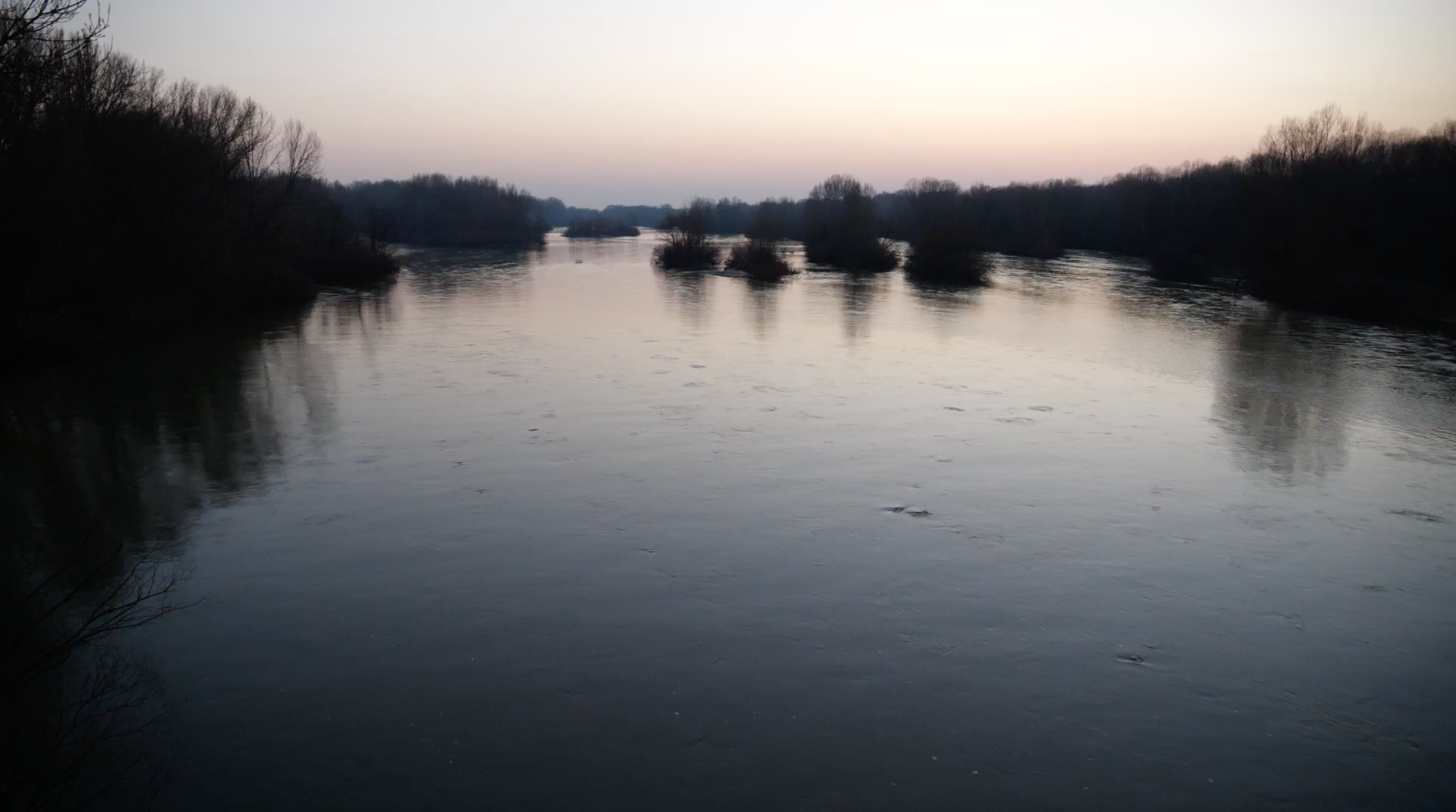
The river is called the Evros in Greek, Meriç in Turkish, and Maritsa in Bulgarian. In this article the name used changes to reflect the cultural and geopolitical division of the region and the river. When the entire river catchment is discussed all three names will be provided. When just the river border between Greece and Turkey is referred to, this changes to Evros/Meriç. When one name is provided, the river is addressed from the context of the relevant side of the border.

2

“България изпуска язовир Ивайловград, за да спре мигрантите през Марица (Bulgaria release the Ivaylovgrad dam to stop migrants through Maritza),” Off News, March 10, 2020, . The Duke, Twitter, March 10, 2020, .

3

According to informal conversations we had with locals, in the days following the 10th of March, the water levels rose but the river never eventually flooded. Satellite photos support these claims, registering a small increase in water levels, which could nevertheless be attributed to rainfall. See Rémi Banet and Diana Simeonova “Articles Falsely Claim Bulgaria Flooded a Dam to Stop Migrants Crossing,” AFP Fact Check, March 16, 2020, .

4

Forensic Architecture, “Joint Statement on the Ongoing Violence on theGreece-Turkey Border,” March 5, 2020, . Refugee Accommodation and Solidarity Space City Plaza, “A farewell to our friend Muhamad Gulzar, killed at Evros Border,” Facebook, March 7, 2020, .

5

John W. Donaldson, “Paradox of the moving boundary: Legal heredity of river accretion and avulsion’ Water Alternatives 4, no. (2011): 155–170, 159.

6

Donaldson, 159, quoting Hugo Grotius, Of the Rights of War and Peace (London: Brown, Ward, Meares, 1715).

7

A concept most frequently referred to as “prevention through deterrence” in the case of the US border guard policy at the border with Mexico.

8

See FRONTEX Serious Incident Reports no. 211 and no. 407. “Technical obstacle” is used as a catch all term for impediments applied against foreign military movement as well as irregular border crossers or smugglers. It is used in a similar fashion to the description of minefields and cluster-bombs as “situational obstacles.” “Technical obstacles” do not stop crossings but merely contain and redirect them elsewhere.

9

Το ΒΗΜΑ Team, “Επεκτείνεται ο φράχτης του Έβρου στα ελληνοτουρκικά σύνορα (The Evros Fence along the Greek-Turkish Border is extended),” Το ΒΗΜΑ, March 5, 2020, .

10

pronewsTV, “Έβρος: Αγρότης ψεκάζει μετανάστες και οι αστυνομικοί παρακολουθούν (Evros: Farmer Sprays migrants while policemen watch),” YouTube, March 8, 2020, .

11

“Tear gas hits the fan during clashes on the Greece-Turkey border,” AP News, March 12, 2020, .

12

“Μπλε μπογιά στους αλλοδαπούς για να εντοπίζονται εάν περάσουν τον φράκτη (Blue paint used against migrants to detect if they cross the fence),” Reportal, March 2, 2020, .

13

“Turkish authorities have set fire to the tents housing illegal immigrants on their side of the Evros border,” Greek City Times, March 27, 2020, . According to the Turkish Minister of Interior, the asylum seekers were loaded onto buses and transferred to nine different quarantine camps in Anatolia. “Minister of Interior Soylu: Sports, Fishing and Picnics are Prohibited,” TR24, March 27, 2020, .

14

Jason de León, The Land of Open Graves: Living and Dying on the Migrant Trail (Oakland: University of California Press, 2015).

15

Juanita Sundberg, “Diabolic Caminos in the Desert and Cat Fights on the Río: A Posthumanist Political Ecology of Boundary enforcement in the United States-Mexico Borderlands,” Annals of the Association of American Geographers 101, no. 2 (2011): 318–336.

16

Roxanne Lynn Doty, “Bare life: border-crossing deaths and spaces of moral alibi,” Environment and Planning D: Society and Space 29 (2011): 599–612.

17

What we call, after Achille Mbembe, the production of necro-hydrologies: where rivers become central figures in regimes of terror and the politics of death. Achille Mbembe, Necropolitics (Durham: Duke University Press, 2019).

18

The Trans Anatolian and Trans Adriatic pipelines meet under the Evros river.

19

T. D. Kanellopoulos et al., “Geochemical composition of the uppermost prodelta sediments of the Evros River, northeastern Aegean Sea,” Journal of Marine Systems 63 (2006): 63–78, 65.

20

Dr Yüksel Hoš, Twitter, (28th of February 2020), .

21

Donaldson, “Paradox of the moving boundary,” 167.

22

The 1926 Athens Protocol, an annex to the 1923 Lausanne Peace Treaty, imagined the possibility of fixing the waters in place.

23

I. Dimitrakopoulos, Ta Chersaia Synora tis Helladas (The Land Borders of Greece), PhD Dissertation, (Aristotle University of Thessaloniki, 1986).

24

“Έπεσε ο φράχτης του Έβρου: Ο Σαμαράς τον έχτιζε, η φύση τον παρέσυρε (The fence of Evros fell: Samaras built it, nature carried it away),” News24/7, February 3, 2015, .

25

“Ντοκουμέντο: Έσκαψαν τρύπα κάτω από τον φράχτη στον Έβρο (They dug a hole under the fence in Evros),” News Bomb, October 23, 2017, .

26

ProAsyl, The Greek Council for Refugees, and Infomobile, “Walls of Shame: Accounts from the inside: The Detention Centre of Evros” (April 2012), , 8.

27

Stefan Helmreich, “How to Hide an Island.” In Daniel Daou and Pablo Pérez-Ramos eds., New Geographies 8: Island (Cambridge: Harvard Graduate School of Design, 2017), 82–87, 84.

28

Michel Serres, The Natural Contract, trans. by Elizabeth MacArthur and William Paulson (Ann Arbor: University of Michigan Press 1995), 51–53.

29

Konstantinos Chouvardas and Christos Papapostolou, “River Floods and Crossborder Cooperation: The case of Evros River,” Geographies 27 (2016): 44–71.

30

Angeliki Mentzafou, Vasiliki Markogianni, and Elias Dimitriou, “The Use of Geospatial Technologies in Flood Hazard Mapping and Assessment: Case Study from River Evros’ Pure and Applied Geophysics 174 (2017): 679–700, 680. Bulgarian dams are “mainly for hydropower production and secondarily for irrigation purposes and fish-breeding.”

31

Ibid.

32

Despite dams on upstream Bulgarian tributaries, because of its significance as a border and with little transboundary water management the main course of the river in the Greece/Turkey section has no dams or artificial barriers, rare for such a large river, this may make it an important habitat for fish. See Stamatis Zogaris et al., “Assessment of Riparian Zone and River Island Conditions in a Trans-Boundary Greenbelt: The Evros/Meriç River (Greece-Turkey),” Fresenius Environmental Bulletin 24, no. 1 (2015): 269–277, 275.

33

Heather Cooley and Peter H. Gleick, “Climate-Proofing Transboundary Water Agreements’ Hydrological Sciences 56, no. 4 (2011): 711–718, 715.

34

Stylianos Skias and Andreas Kallioras, “Cross border co-operation and the problem of flooding in the Evros Delta.” In Joris Verwijmeren and Mark Wiering eds., Many Rivers to Cross: Cross Border Co-operation in River Management (Delft: Eburon, 2007), 128.

35

Ibid, 133.

36

“Joint Declaration Between the Government of the Hellenic Republic and the Government of the Republic of Turkey,” Izmir March 2016, signed by prime ministers Alexis Tsipras and Ahmet Davutoglu, .

37

Sandro Mezzadra analyzes this metaphor within public discourse as the use of terminology from communication theory and sociology to render migration “objective’ and separate from the “actions of subjects.” Sandro Mezzadra, “The Right to Escape,” Ephemera 4, no. 3 (2004): 267–275.

38

Lissa Malkki explores a similar process in the case of Tanzania where the metaphor of floods of refugees is mobilised against the perceived threat of refugees. Lissa H, Malkki, Purity and Exile: Violence, Memory, and National Cosmology among Hutu Refugees in Tanzania (Chicago: University of Chicago Press, 1995), 15. Likewise, Emma Haddad draws on the liquid metaphor as uprooting and displacing. Emma Haddad, “Danger Happens at the Border.” In Prem Kumar Rajaram and Carl Grundy-Warr eds., Borderscapes: Hidden Politics and Geographies at Territories Edge (Minneapolis: University of Minnesota Press, 2007), 119–136, 122.

39

Helena Drysdale, “Night vigil in Thrace: Despite its turmoil, ever more people are risking their lives to enter Greece. Welcome to Europe’s most porous border,” AEON, September 17, 2012, .

40

FRONTEX has long considered the Greek-Turkish borders as a laboratory for testing operational diagrams that it goes on to apply elsewhere in Europe. The first Poseidon Operations, Poseidon Sea and Poseidon Land, were launched in 2008, with a focus on safeguarding Greece’s –and by extension, Europe’s external- sea and land borders respectively. Since then, the Poseidon Operations have been periodically renewed and upscaled to what was until recently called Operation Poseidon Rapid Intervention. During the drafting of this piece, Frontex operations were upscaled further to Rapid Border Intervention Evros 2020 and Rapid Border Intervention Aegean 2020. One hundred Frontex officers were deployed to the Evros region on 12/03/2020. FRONTEX, “Frontex launches rapid border intervention on Greek land border,” March 13, 2020, .

41

Jennifer Rankin, “EU Praises Greece as “Shield’ After Turkey Opens Border,” The Guardian, March 3, 2020, .

42

M. Rombou-Levidi, “’Dancing Beyond the “Barre’: Cultural Practices and the Processes of Identification in Eastern Macedonia, Greece,” unpublished PhD dissertation, (University of Sussex, 2009), 8–9.

43

Including two cases brought by Forensic Architecture in the last four months: Forensic Architecture, “Pushbacks Across The Evros/Meriç River: The Case Of Ayşe Erdoğan” February 8, 2020, ; Forensic Architecture, “Pushbacks Across The Evros/Meriç River: Analysis Of Video Evidence,” December 13, 2019, .

44

“14 Travellers attempt to cross Turkish-Greek land border, one dead person,” Watch the Med, May 8, 2018, .

45

Demetris Angelidis, “They took my papers, took me to the river, and passed me across…,” EFSYN, February 12, 2018), .

46

As Pavlos Pavlidis, coroner at the university hospital of Alexandroupolis, told us in an informal interview, seasonal floods often also perform the opposite role. The rising waters untangle bodies that had been caught in twigs or swallowed by the mud for months and render death in the Evros/Meric visible.

47

Forensic Architecture, Twitter, March 12, 2020, . Matina Stevis-Gridneff, Patrick Kingsley, Haley Willis, Sarah Almukhtar, and Malachy Browne “’We Are Like Animals’: Inside Greece’s Secret Site for Migrants,” The New York Times, March 10, 2020, .

48

Rob Nixon, Slow Violence and the Environmentalism of the Poor (Cambridge: Harvard University Press, 2011).

49

Stefanos Levidis & Ifor Duncan, “Sounding the Arcifinious,” Movement Radio, February 23, 2020, .

50

Pavlidis has said: “Those who die from hypothermia can maintain the last body posture and facial expression they had when they fell asleep.” “Crossing Through the Land Border: What are the Risks,” Stop Evros Wall, March 2, 2019, .

51

Nello Scavo, “Tra Turchia e Grecia. Cani, doppiette, trattori e neonazi: la caccia ai profughi,” Avvenire, March 12, 2020, .

52

See the work of Anuradha Mathur and Dilip Da Cunha on the expanded de-colonial conceptions of rivers and in particular deltaic and estuarine space. Anuradha Mathur and Dilip Da Cunha, Soak: Mumbai in an Estuary (New Delhi: Rupa Publications, 2009). Dilip Da Cunha, The Invention of Rivers; Alexander’s Eye and Ganga’s Descent (Philadelphia: University of Pennsylvania Press, 2018).

53

Anssi Paasi, “Border studies reanimated: going beyond the territorial/relational Divide,” Environment and Planning A 44, no. 10 (2012): 2303–2309, 2304.

At The Border is a collaboration between A/D/O and e-flux Architecture within the context of its 2019/2020 Research Program.

Category
Borders & Frontiers, Migration & Immigration, Nature & Ecology
Subject
Water & The Sea, Eastern Europe, Accidents & Disasters, Refugees
Return to At The Border

Ifor Duncan is a writer and inter-disciplinary researcher with a specific focus on the overlaps of political violence with degrading watery spaces, processes, and materialities. He is Lecturer in Research Architecture at the Centre for Research Architecture, Goldsmiths, University of London.

Stefanos Levidis is a researcher at Forensic Architecture and PhD candidate at the Centre for Research Architecture (CRA), Goldsmiths, University of London.

Advertisement
Subscribe

e-flux announcements are emailed press releases for art exhibitions from all over the world.

Agenda delivers news from galleries, art spaces, and publications, while Criticism publishes reviews of exhibitions and books.

Architecture announcements cover current architecture and design projects, symposia, exhibitions, and publications from all over the world.

Film announcements are newsletters about screenings, film festivals, and exhibitions of moving image.

Education announces academic employment opportunities, calls for applications, symposia, publications, exhibitions, and educational programs.

Sign up to receive information about events organized by e-flux at e-flux Screening Room, Bar Laika, or elsewhere.

I have read e-flux’s privacy policy and agree that e-flux may send me announcements to the email address entered above and that my data will be processed for this purpose in accordance with e-flux’s privacy policy*

Thank you for your interest in e-flux. Check your inbox to confirm your subscription.