Issue #101 Ocean Sensing and Navigating the End of this World

Ocean Sensing and Navigating the End of this World

Jennifer Gabrys

Argo Instrument Animations, NASA/Goddard Space Flight Center Conceptual Image Lab (2008).

Issue #101
June 2019

Edges and ends of worlds are encountered frequently in the films of Harun Farocki. They form recurrent courses of navigation, tugging along ships and airplanes, riders and avatars, waves and clouds, memories and simulations. In one sequence in the eight-minute-long film Parallel II, a rider on horseback charges toward a horizon that at once recedes and refreshes. While the riding is swift and purposeful, it also folds back on itself, creating the conditions that would make or give sense to the journey. The rider and horse gallop along a dusty track as though in search of someone or something. Just as the purpose of the scene would sharpen into focus, the rider traverses into another refreshed landscape that presents an altered visual frame oriented toward a new pursuit. Rather than the rider following a self-defined objective, the computer world delineates the arc and aim of the journey, of which the rider is merely an expression or effect. In this scene from Parallel II, the narrator relates:

Galloping swiftly out from the gate
How far can the rider ride?
Where does this world end?
This world appears infinite
A world generated by the gaze that falls upon it.

These are self-generating worlds. The contours of these worlds propel navigational practices that simultaneously unfold the narrative and structure of computer games. Parallel II is one film within the four-part film installation Parallel I–IV (2012–14), where Farocki explores computer vision and video games.1 By probing at the logics of computer vision and navigation, Farocki tests the limits of worlds, both in terms of their mechanics and structure, as well as what they operationalize. By deliberately staging confrontations with these edge conditions, figures in Parallel I–IV traverse building edges and scramble along cliff faces to demonstrate how these worlds are constructed, and how they in turn organize ways of seeing, sensing, and feeling. Working in the context of computer games, Farocki draws attention to the shifting digital horizons that the gamer–player navigates in any particular game world. These digital technologies inform ongoing navigational practices, as well as ways of encountering and ending worlds—this one, or those to come.

World-ending is by now a pervasive topic. It is the default script written into the story of environmental change. Yet it is also a concept and event with a longer history. Worlds are projected to end in the face of climate breakdown, with people displaced and dispossessed from melting landscapes and submerged communities. Worlds have also continually been ending, with settler colonialism, environmental racism, and ecological exhaustion wreaking terminal destruction over the span of several centuries. The worlds and endings that are conjoining and collapsing are then many, with different consequences for the inhabitants and relations of those worlds. In the context of this issue of e-flux journal on navigation, I begin with Farocki’s computer-game provocation to consider the question of where this world ends, especially through digital environmental sensing technologies tuned to detecting environmental change. How are worlds delineated, and their endings sensed, within a matrix of catastrophic environmental events and digital sensing technologies? Operating in a different register than computer games, environmental sensors nevertheless sense and make worlds that also express distinct edge and limit conditions.

The worlds I explore here are ocean worlds. They are less exclusively situated within the realm of the virtual, and are more distributed as particular ontogenetic formations that concretize through what I call the “becoming environmental of computation.”2 The becoming environmental of computation involves not merely the extension of sensor technologies across multiple different ecosystems, but also in-forms ways of encountering environments and environmental change. Sensors directly and indirectly detect the increasing pollution of oceans with plastics, rising temperatures, and accumulating carbon dioxide as it converts to carbonic acid. Oceans are spaces that are increasingly approaching limit conditions, from rising temperatures and acidification to saturation with plastic debris, sea-floor mining, habitat destruction, and the industrialization of ocean spaces.3

In this essay on ocean sensing and navigating the end of this world, I consider how Argo floats, remote-sensing satellites, wave buoys, and ship sensors assemble to form a world or worlds to be acted upon and navigated. By attending to these distinct forms of environmental sensing practices,4 I examine the limit conditions and points of transformation that these sensing ensembles detect, especially in the form of oceans contaminated with plastic pollution and altered by climate change through rising temperatures and acidification. How do sensing and navigational strategies that unfold through digital ocean sensor systems tilt toward the end of this world by calculating and predicting the saturation of oceans with thermal pollution and plastics, as well as carbon dioxide and toxins?

These sensor systems monitor the accumulation of pollutants in ocean spaces, and as they navigate through ocean spaces with the aid of satellite and tracking systems, they also give rise to speculations about how to navigate the end of a world, or indeed how to move beyond a horizon for which there is no clear course of action. At the same time, the end of this world is a designation that is up for grabs, as many writers from Fred Moten to Déborah Danowski and Eduardo Viveiros de Castro have noted. Multiple worlds have already ended through environmental, racial, and economic violences that have razed possibilities for being otherwise. This provokes the question: Which world is this world that could be ending? How might these sensor systems or perceptive capacities then be extended to attend to worlds that have already ended, or that might be hastened along in their endings?

Plastic Oceans

Located across the world’s oceans are several sizeable concentrations of plastic debris that have variously earned the title of “garbage patches.” The Great Pacific Garbage Patch in particular has become an object of popular and scientific interest. It is an environmental anecdote to confirm our worst fears about overconsumption—and the dark side of the durable wonders of plastics that were promoted in so many postwar contexts. It is also an imagined indicator of what may even outlive us, given the lengths of time that plastics require to degrade. The garbage patch is in many ways an amorphous object, drifting through oceanic and media spaces as an ominous sign that focuses attention toward the ways in which oceans have become planetary-sized landfills. Yet it also signals a certain world-ending moment, arriving as the oceans become saturated with this synthetic and disposable material.

Popular imaginings of the Pacific Garbage Patch have included comparisons of its size to the state of Texas, or suggestions that it is an island that might be named an eighth continent, formed of anthropogenic debris. Upon hearing of the concentration of plastic wastes in the Pacific, many people search for visual evidence of this environmental contamination on Google Earth. Surely a human-induced geological formation of this magnitude must be visible even from a satellite or aerial view? However, because the plastic wastes are largely present as microplastics in the form of photo-degraded and weathered particles, the debris exists more as a suspended soup of microscopic particles that is mostly undetectable at the surface of the ocean.

While Google Earth may be a platform for visualizing and locating ocean data,5 this visualization technique presents a much different approach to “sensing” than seeing the patch as a photographic object. The inability to locate the garbage patches on Google Earth, a tool for scanning the seas through a conjunction of remote sensing, aerial photography, and online interfaces, even gives rise to popular controversy about how to locate the patch and whether the plastic conglomerations are actually present in the oceans, and if so, how to address the issue. The relative invisibility and inaccessibility of the patches render them as looming imaginative figures of environmental decline and yet relatively amorphous and unlocatable and so seemingly resistant to incentives toward environmental action. All of which raises the question: To what extent do environmental problems need to be visible in order to be actionable? Or do they instead become sense-able and navigable in different ways, less as images that raise concern, and more as shifting conditions that unevenly surface and require unfolding and expanded sensing practices and tactics? As Farocki’s computer game investigations indicate, modes of navigation and sensing can also become ways of constructing these worlds, and their edge conditions.

If Google Earth or a satellite view of the garbage patch proves to be an impossible undertaking, it is because the plastics suspended in oceans are not a thick choking layer of identifiable objects but more a confetti-type array of suspended plastic bits. Locating the garbage patch is on one level bound up with determining what types of plastic objects collect within it and what effects they have. Yet on another level, locating the garbage patch involves monitoring its shifting distribution and extent in the ocean. The garbage patch is not a fixed or singular object, but a society of objects in process. The composition of the garbage patch consists of plastics interacting across organisms and environments. But it also moves and collects in distinct and changing ways due to ocean currents, which are influenced by weather and climate change, as well as the turning of the earth (in the form of the Coriolis effect) and the wind-influenced direction of waves (in the form of Ekman transport). As an oceanic gyre, the garbage patch moves as a sort of weather system, shifting during El Niño events, and changing with storms and other disturbances.6 Ocean sensing then requires forms of monitoring that work within these fluid and changeable conditions.

The garbage patch as a figure does not directly come into view through ocean-sensing practices and technologies, but instead registers in a more indirect way, through proxy sensing. Environmental monitoring techniques often developed for purposes other than sensing plastics are subsequently tuned in to the drift of oceanic debris. Most sensors are set to detect salinity, temperature, and movement of ocean currents in order to bring patterns of climate change into view, a similarly elusive event that is not easily visualized. Rather than a visual fix on plastic pollution, sensing practices and technologies for monitoring environmental change instead indirectly register plastics within the mix of other environmental processes, geopolitical infrastructures, and digital devices.

ARGO Float Animation #2, NASA/Goddard Space Flight Center Scientific Visualization Studio (2002-2005).

Sensorized Oceans

Oceans have become highly instrumented sensor spaces. An extensive array of sensing nodes and drifting sensor points can be found on buoys and hulls of boats, underwater gliders, and Argo floats (instrument platforms for observing oceanic temperature, salinity, and currents). Ocean sensing also occurs via coastal webcams, remote satellites, remotely operated vehicles (ROVs), autonomous underwater vehicles (AUVs), airborne sensors, unmanned aerial vehicles (UAVs), high-frequency radar, instrumented drilling platforms, and apps that citizens can use to document marine debris sightings.7 Marine traffic tracking sites also document the movement of container ships and other large vessels; and some platforms and maps focus on capturing data from ocean-going objects that are part of the Internet of Things, revealing just how densely populated oceans and seas are with sensing devices.8

The importance of monitoring oceans has increased considerably, since oceans are the primary sink that absorbs both CO2 and heat, and the dynamics of these sink-based processes are less well understood in relation to climate change.9 While many sensors are in place to take temperature observations, as well as feed into climate-change monitoring and modeling, other sensors are used to survey noise underwater in order to prevent damage to marine organisms’ ability to navigate these spaces. On one hand, there has been a lack of monitoring in the oceans, which current practices are attempting to mitigate. On the other, the current spread of instrumentation is leading some researchers to propose remote access to the ocean from any number of sensor networks. As Stefan Helmreich writes in one instance about the proposed establishment of a “distributed ocean observatory,” this project would involve “a network of remote sensing buoys that can provide continual Web access to data from the sea” and “would allow scientists to sit in their living rooms gathering oceanographic data.”10 One imagines scientists becoming avatars in an ocean-world computer game, searching out signals of environmental distress, while also asking, where does this world end?, as the ocean observatories generate more evidence of catastrophic environmental change.

The becoming environmental of computational sensors in oceanic spaces involves the instrumentation of oceans via extensive sensing networks as well as the reworking of the environments in which sensing takes place (from underwater to living rooms). Yet computational sensors become environmental in yet another way, where sensors themselves might be adapted to ocean environments and processes, with drifting buoys, Argo floats, and sensors on vessels circulating through oceans across surfaces, sub-surfaces, and at depths now down to six thousand meters.11 And as sensors fill these spaces and provide monitoring data, they also generate other sensor tales, including observations about the likely drift of marine debris (especially in the form of plastic) through ocean currents, along with the increasing temperature of ocean spaces. Oceans might then be seen as an environmental medium with medial effects, guiding and informing the very sensing instruments that would navigate and make sense of oceanic spaces.

Ocean sensing and the detection of pollution, plastics, rising temperatures and carbon levels then involves numerous sensing instruments, including most pervasively Argo floats. Since 2000, thousands of Argo floats have been deployed to form a worldwide ocean-observing system. With nearly four thousand drifting Argo floats now in circulation (and over 2 million dive profiles contributing to global datasets), the Argo system captures temperature and salinity data that informs climate-change projections, while providing a map of ocean currents. Along with climate data, other ocean events such as plastic accumulation also surface as part of the tracking and tracing that Argo floats perform. The floats drift and dive down to one thousand and two thousand meters, and surface, providing data on conductivity and temperature, pressure, salinity, and location. As a communication system composed of Argo floats and the Jason satellite mission, this ocean sensing at once signals Greek mythologies of navigation, the accumulated histories of colonial shipping routes, as well as near-future trajectories for steering Spaceship Earth through the gathering storms of planetary collapse in the form of climate change and the collapse of ocean spaces.

Similar techniques for mapping the circulation of ocean debris include systems such as the Global Drifter Program, one ocean observation project among many that has deployed surface drifting (rather than diving) buoys equipped with sensors that communicate with satellites, and which are used to study the drift of plastics and other debris in the oceans. Using drifter tracing and sensor communications, the Global Drifter Program has deployed tracking buoys that communicate with satellites to establish circulation patterns in ocean currents. Along the way, the drifters have also become devices for establishing the likely movements of marine debris, since where the drifters collect is likely to indicate the same locations in which other flotsam collects.12

The Global Drifter Program consists of a platform of more than 1,250 drifting buoys that have been deployed over several decades spanning from initial development in 1979 to current annual mass deployments to monitor the oceans.13 The buoys monitor the upper water column and provide information on ocean surface and atmospheric conditions, as well as fluxes between air and sea. Run through the Atlantic Oceanographic and Meteorological Laboratory (AOML) in Miami, Florida, the drifters are deployed at study sites and then circulate across oceans. Detecting and sensing sea surface temperature, barometric pressure, wind velocity, ocean color, salinity, and subsurface temperatures, the buoys monitor ocean conditions primarily to determine weather and climate patterns. As they circulate, the buoys can also send one-hundred-and-forty-character messages on location and ocean conditions— what physical oceanographer Erik van Sabille has referred to as “Twitter from the ocean.”14 Part of the Global Earth Observation System of Systems (GEOSS) of monitoring technologies, the Global Drifter buoys also link up with earth models to provide forecasting data.

In addition to functioning as weather, climate, and circulation observation devices, the drifters have provided detailed and longer-term data on the likely movement of debris in oceans. A high proportion of drifters has gravitated toward the five gyres, and in this sense the drifters have provided further data for establishing where gyres are located and how long drifters or debris may converge in these areas.15 Global Drifter data has led to the identification of a sixth Arctic gyre, as well as observations about the ways in which patches are “leaky” and circulate debris across regions, potentially over a time span of centuries.16 The drifters are in many ways proxies for demonstrating how debris travels over time in oceans, how debris converges in gyres, and the length of time it may take debris to exit convergence zones (if at all) and wash up in coastal regions. The drifters were not originally developed as monitoring devices to study the accumulation of debris directly, since they focused on ocean circulation patterns. But the drifters became an imported technique for studying how debris circulates and settles in ocean spaces in relation to the study of ocean circulation. The drifters also eventually become debris, as they have a limited (five-year) battery life, and cease to function due to mechanical error, environmental stress, and more.17

The Global Drifter Program potentially not only validates or corrects prior and differing studies on ocean circulation but also provides a more real-time observation platform for understanding how gyres may shift—and debris concentrations along with them. In many ways, the ongoing deployments, shifting oceanic trajectories, and real-time communication of the drifters are practices that emerge in relation to and through a fidelity to the shifting techno-scientific objects under study. The sensing and satellite-linked drifters enable sensing practices that are able to more continually monitor these shifting conditions and processes. Sensing buoys concresce along with the circulation patterns and debris under study, thereby materializing a distinctly environmental and oceanic form of computational sensors. The shifting materialities of the garbage patch in-form the technologies that come to be used to monitor them. Littered oceanic spaces are co-constituted through the becoming environmental of these computational monitoring technologies. Environmental monitoring techniques “sense” an object such as the garbage patch that is relatively invisible and continually in process by navigating with and through ocean currents, in turn proxy-sensing the routes of plastics.

Oceans and objects are sites for sensing practices in the making. Drifters and sensors, together with studies of particle movement and ocean currents, are both abstract approaches to understanding the garbage patch, as well as concrete things that navigate as they generate worlds to be sensed.18 Such techno-scientific observation techniques focused on marine debris in the gyres inevitably also mobilize responses for remediating and managing the issue of plastics in the seas. In this sense, the garbage patch in its intractable plasticity gives rise to techno-scientific practices not just to monitor but also to repair, control, or manage this object of study and concern.19 Emerging systems for sensing oceans materialize as information infrastructures with embedded modes of governance. Yet these attempts to monitor the ocean might also arrive at the inability to arrive at a knowable or governable ocean.20 Ocean-sensing practices reach a limit condition, where they observe and yet cannot fully predict the phase changes that the oceans will experience with plastics pollution and climate breakdown.

Such stress-testing of drifters and oceans resonates with the opening scene of Farocki’s early film Images of the World and the Inscription of War (1989), where a wave machine in a laboratory creates waves that simulate, test, and observe the meeting zone between wave and land, as a technique that speculates toward the likely effects of waves on navigational abilities. Yet the wave machine cannot possibly capture the full array of waves likely to be encountered, or know the conditions that might cause these navigational challenges. The wave machine constructs conditions that imperfectly align with the stochastic wave worlds of multiple seas and oceans.

The material occasions of oceans are not only a remote object of digital study, but also an actual occasion in which we are now participating and through which we will continue to be affected. Here, new societies of objects emerge from the remains of techno-scientific pursuits and in turn give rise to new monitoring practices for studying these residual and yet generative objects with unknown and indeterminate effects. A key question arises from monitoring the oceans as generative techno-scientific and computational objects: What experimental forms of politics and environmental practices might materialize that are able to attend to these indeterminate and emergent effects, which also portend the end of a world, if not this world?

Sensing the End of this World

In a pluralistic ontological register, we could say that there is already more than one world in the present; and yet the world that is navigated via sensing technologies is presented as one that is at a saturation point and under crisis. By tracking the geo-spatial recordings of these ocean-sensing systems, it is then possible to ask, along with Farocki, where does this world end? Or in other words, how do sensing and navigational technologies chart the contours of a world that seems to be continually approaching an ending, while also suggesting strategies for sensing, mapping, navigating, and inventing worlds otherwise? Beyond navigating the end of this world through sensing devices, it could be possible to tune into other worlds that are typically not on the maps of drifts and floats. This is another way of suggesting that it could be possible to reassess the politics and “ontology of the navigational.”21

These multiple worlds surface other sorts of “residence time,” as Christina Sharpe has written about seafaring and oceanic spaces in the context of slavery and the “amount of time it takes for a substance to enter the ocean and then leave the ocean.”22 A concept from oceanography, residence time refers to the extended time frames within which materials, pollution, heat, and more circulate and transform within and through ocean spaces. Indeed, the plastics, heat, and carbon dioxide that are added to oceans can take many decades or centuries to circulate, with materials from the mid-twentieth century surfacing only now. Yet along with these chemical-material markers of extraction, there are also other entities churning through oceans that are less easily detectable through sensor technologies. Sharpe addresses the legacies of colonialism and slavery that have traversed oceanic spaces and left residues of bodies, violence, and inequality that continue to cycle through the depths, surfacing and recirculating further material histories of these events.23 All that circulates through oceans also makes worlds, which can create violent and destructive spaces to navigate. They force the question: When will the residence time of this world come to an end, and how will the “end” be navigated?

Indeed, these endings might also indicate how the time of the present is “already dystopian,” as Kyle Powys Whyte has suggested in relation to “indigenous perspectives on climate change.” In other words, the rupture that marks endings in fact permeates present conditions, rather than being something that is yet to come.24 Rather than search for strategies to sustain this world, such perspectives suggest other approaches and practices that might be tuned toward science fiction, in order to draw out the sedimented endings and forms of environmental and colonial violence that are undergirding this world, and to speculate toward other environmental inhabitations.

Or, as Fred Moten has suggested in the Undercommons, this world might not be suitable for repair and so should not be engaged with through recuperative logics and practices.25 Rather than extend and maintain this world, its end should be hastened along in order to build something new. The question of what this world is within the context of a black radical tradition takes on another designation that suggests the limitations of what might be sensed and engaged with as self-evident. The sense of “common sense” is a social and political settlement that often elides the subjugating conditions that have enabled these forms of sense-making. Denise Ferreira da Silva picks up on the topic of the end of the world and suggests that by surpassing “the known and knowable World” it might also be possible to exceed universal subjects, racial subjugation, and “efficient causality.” This is a way of “opening up the possibility for a radical departure from a certain kind of World.”26 The world that could be ending, that could be proposed to be ending, is always a particular construction that makes possible some inhabitations and not others. How such worlds are sensed, the ontologies that they operationalize, and the endings that are traversed, are conditions to be queried and even exceeded.

There are multiple worlds and multiple endings layered into these discussions,27 as well as emerging through the sensing systems and sensing practices of environmental observatories and geopolitical infrastructures. Returning to Farocki’s Parallel series, one can begin to consider the emergence of speculative practices and technologies for navigating at and beyond the end of this world. Toward the end of Parallel II, the narrator, having cycled through multiple game worlds, describes a program that is meant to prevent “the game figures from falling off the edge of the world.” Yet in another game it is also possible to change the settings and cross over the edge of the game, making it “possible to break through the safety barrier and fall out into space” where one would free fall “like an astronaut catapulted from his spaceship.” Where the limits of the game are made visible, and the end of this world is encountered, there is a distant urban conglomeration, a black cavernous space, and a subject in free fall.

By attending to the constructions of worlds, as well as the ends of worlds, it is possible to engage with how these ways of seeing, sensing, feeling, and navigating test the boundaries and conditions of worlds. The end of this world could occur on one level through the saturation, pollution, acidification, and defaunation of oceans as they alter through environmental change. Yet this ending and ways of sensing this ending also suggest that it could be necessary to attend to how these worlds are constructed, as environments of distributed computation, as digital worlds in the making, and as sedimented zones of colonial extraction and subjugation that continue to be plundered for labor, minerals, and resources. What does not show up at the edges of these worlds are the conditions whereby these worlds have been constructed—the navigational meshes, as Farocki has captured them. These navigational meshes are the parallel yet often hidden infrastructures that support and enable worlds and their circumnavigation. When brought into view, they show up as the wireframe guides and coded protocols for operating within a particular zone. Navigational meshes could even constitute parallel worlds, a matrix of programs and programmability that could be rendered and reconstituted. By devising speculative instruments for tuning into these parallel worlds, it might be possible to sense the limit conditions of extractive ontologies, and to navigate beyond endings toward potentialities for otherwise inhabitations.

Notes
1

Harun Farocki (with Matthias Rajmann), Parallel I–IV (2012–14).

2

Jennifer Gabrys, Program Earth: Environmental Sensing Technology and the Making of a Computational Planet (University of Minnesota Press, 2016).

3

Douglas J. McCauley, Malin L. Pinsky, Stephen R. Palumbi, James A. Estes, Francis H. Joyce, and Robert R. Warner, “Marine Defaunation: Animal Loss in the Global Ocean,” Science 347, no. 6219, 1255641 (January 16, 2015), DOI: 10.1126/science.1255641.

4

For an extended investigation into the topic of sensing practices, see the forthcoming special issue “Sensors and Sensing Practices: Reworking Experience across Entities, Environments and Technologies,” eds. Jennifer Gabrys, Helen Pritchard, and Lara Houston, Science, Technology & Human Values (2019).

5

For example, see National Center for Ecological Analysis and Synthesis, “A Global Map of Human Impacts.” Not to be confined to surface views of the ocean, Google Earth has also added a “Street View” for navigating underwater—see and .

6

Evan A. Howell, Steven J. Bograd, Carey Morishige, Michael P. Seki, and Jeffrey J. Polovina,“On North Pacific Circulation and Associated Marine Debris Concentration,” Marine Pollution Bulletin 65, nos. 1–3 (2012): 16–22.

7

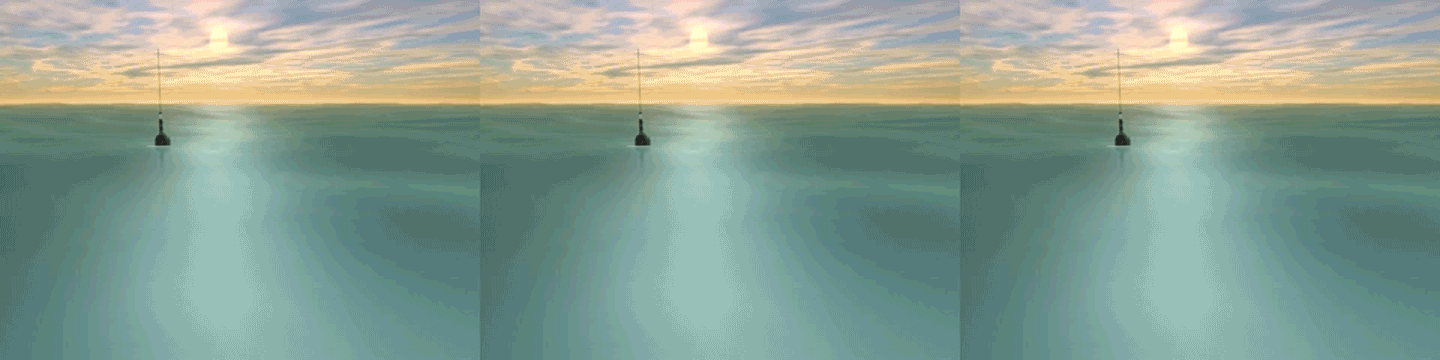
Kathleen Dohan and Nikolai Maximenko, “Monitoring Ocean Currents with Satellite Sensors,” Oceanography 23, no. 4 (2010): 94–103; International Pacific Research Center (IPRC), “Tracking Ocean Debris,” Newsletter of the International Pacific Research Center 8, no. 2 (2008): 14–16 ; Southeast Atlantic Marine Debris Initiative (SEA-MDI), “Want to Track Marine Debris? There’s an App for That” .

8

Marine Traffic ; Thingful .

9

Justin Gillis, “In the Ocean, Clues to Change,” New York Times, August 11, 2014 . See also Jennifer Gabrys, “Sink: The Dirt of System,” Environment and Planning D: Society and Space 27, issue 4 (2009), 666–81; and Jennifer Gabrys, “Plastic and the Work of the Biodegradable,” in Accumulation: The Material Politics of Plastic, eds. Jennifer Gabrys, Gay Hawkins, and Mike Michael (Routledge, 2013), 208–27.

10

Stefan Helmreich, “Intimate Sensing,” in Simulation and Its Discontents, ed. Sherry Turkle (MIT Press, 2009), 148. See also Stefan Helmreich, Alien Ocean: Anthropological Voyages in Microbial Seas (University of California Press, 2009).

11

UK Argo, “Deep Profile Floats” .

12

Nikolai Maximenko, Jan Hafner, and Peter Niiler, “Pathways of Marine Debris Derived from Trajectories of Lagrangian Drifters,” Marine Pollution Bulletin 65, nos. 1–3 (2012): 51–62.

13

Rick Lumpkin and Mayra Pazos, “Measuring Surface Currents with Surface Velocity Program Drifters: The Instrument, Its Data, and Some Recent Results,” in Lagrangian Analysis and Prediction of Coastal and Ocean Dynamics (LAPCOD), eds. Annalisa Griffa, A. D. Kirwan, Arthur J. Mariano, Tamary Ozgokmen, and Thomas Rossby (Cambridge University Press, 2007), 39–67.

14

Newsroom UNSW (University of New South Wales, Australia), “Our Plastics Will Pollute Oceans for Hundreds of Years,” January 9, 2013 .

15

Dohan and Maximenko, “Monitoring Ocean Currents with Satellite Sensors”; Laurent C. M. Lebreton, S. D. Greer, and Jose Carlos Borrero, “Numerical Modeling of Floating Debris in the World’s Oceans,” Marine Pollution Bulletin 64, no. 3 (2012): 653–61; Maximenko, Hafner, and Niiler, “Pathways of Marine Debris.”

16

Erik van Sebille, Matthew H. England, and Gary Froyland, “Origin, Dynamics, and Evolution of Ocean Garbage Patches from Observed Surface Drifters,” Environmental Research Letters 7, no. 4 (2012), DOI: 10.1088/1748–9326/7/4/044040.

17

Rick Lumpkin, Nikolai Maximenko, and Mayra Pazos, “Evaluating Where and Why Drifters Die,” Journal of Atmospheric and Oceanic Technology 29, no. 2 (2012): 300–08.

18

Stefan Helmreich, “Nature/Culture/Seawater,” American Anthropologist 113 (2011): 132–44; Isabelle Stengers, “A Constructivist Reading of Process and Reality,” Theory, Culture & Society 25, no. 4 (2008): 91–110.

19

Bernadette Bensaude-Vincent, Sacha Loeve, Alfred Nordmann, and Astrid Schwarz, “Matters of Interest: The Objects of Research in Science and Technoscience,” Journal for General Philosophical Science 42, no. 2 (2011): 365–83.

20

Jessica Lehman, “A Sea of Potential: The Politics of Global Ocean Observations,” Political Geography 55 (2016): 113–23. In her analysis of ocean governance, Lehman draws on Elizabeth Povinelli’s geontopolitics. See Elizabeth A. Povinelli, Geontologies: A Requiem to Late Liberalism (Duke University Press, 2016).

21

Tom Holert, “Meshed Space: On Navigating the Virtual,” in Myths of the Marble, eds. Milena Hoegsberg and Alex Klein (Sternberg Press, 2018).

22

Christina Sharpe, In the Wake: On Blackness and Being (Duke University Press, 2016), 41.

23

See also Paul Gilroy, The Black Atlantic: Modernity and Double Consciousness (Harvard University Press, 1995); and Elizabeth DeLoughrey, “Heavy Waters: Waste and Atlantic Modernity,” PMLA 125, no. 3 (2010): 703–12.

24

Kyle P. Whyte, “Indigenous Science (Fiction) for the Anthropocene: Ancestral Dystopias and Fantasies of Climate Change Crises,” Environment and Planning E: Nature and Space 1, nos. 1–2 (2018), 224–42. As Whyte writes: “Some Indigenous perspectives on climate change can situate the present time as already dystopian. Instead of dread of an impending crisis, Indigenous approaches to climate change are motivated through dialogic narratives with descendants and ancestors. In some cases, these narratives are like science fiction in which Indigenous peoples work to empower their own protagonists to address contemporary challenges.” Or as Kathryn Yusoff writes: The Anthropocene might seem to offer a dystopic future that laments the end of the world, but imperialism and ongoing (settler) colonialisms have been ending worlds for as long as they have been in existence.” See A Billion Black Anthropocenes or None (University of Minnesota Press, 2018).

25

Moten states: “Like Deleuze. I believe in the world and want to be in it. I want to be in it all the way to the end of it because I believe in another world in the world and I want to be in that. And I plan to stay a believer, like Curtis Mayfield. But that’s beyond me, and even beyond me and Stefano, and out into the world, the other thing, the other world, the joyful noise of the scattered, scatted eschaton, the undercommon refusal of the academy of misery.” In Stefano Harney and Fred Moten, The Undercommons: Fugitive Planning & Black Study (Autonomedia, 2013), 118.

26

Denise Ferreira da Silva, “Toward a Black Feminist Poethics: The Quest(ion) of Blackness toward the End of the World,” The Black Scholar 44, no. 2 (2015): 85–86.

27

Déborah Danowski and Eduardo Viveiros de Castro, The Ends of the World, trans. Rodrigo Nunes (Polity Press, 2017).

Category
Nature & Ecology, Technology
Subject
Water & The Sea, Climate change, Experimental Film, Apocalypse, Science, Maps, Pollution & Toxicity
Return to Issue #101

This text includes portions of an abbreviated and revised reprint from chapter 5 of Program Earth, courtesy of the University of Minnesota Press.

Jennifer Gabrys is Chair in Media, Culture and Environment in the Department of Sociology at the University of Cambridge, and Honorary Visiting Professor in the Department of Sociology at Goldsmiths, University of London. She is Principal Investigator on the projects Citizen Sense and AirKit, both funded by the European Research Council. Her books include Program Earth: Environmental Sensing Technology and the Making of a Computational Planet (2016) and How to Do Things with Sensors (forthcoming).

Advertisement
Subscribe

e-flux announcements are emailed press releases for art exhibitions from all over the world.

Agenda delivers news from galleries, art spaces, and publications, while Criticism publishes reviews of exhibitions and books.

Architecture announcements cover current architecture and design projects, symposia, exhibitions, and publications from all over the world.

Film announcements are newsletters about screenings, film festivals, and exhibitions of moving image.

Education announces academic employment opportunities, calls for applications, symposia, publications, exhibitions, and educational programs.

Sign up to receive information about events organized by e-flux at e-flux Screening Room, Bar Laika, or elsewhere.

I have read e-flux’s privacy policy and agree that e-flux may send me announcements to the email address entered above and that my data will be processed for this purpose in accordance with e-flux’s privacy policy*

Thank you for your interest in e-flux. Check your inbox to confirm your subscription.