Issue #109 Like a Map Over Troubled Water: (Un)mapping the Mediterranean Sea’s Terraqueous Necropolitics

Like a Map Over Troubled Water: (Un)mapping the Mediterranean Sea’s Terraqueous Necropolitics

Laura Lo Presti

Wiktor Dyndo, Wave, 2015. Courtesy of the artist.

Issue #109
May 2020

Throughout history, the seascape, both as a metaphor and as a material and cultural formation, has been poetically and philosophically imagined through characteristics such as fluidity, vibrancy, and movement. For a recent example, geographers Philip Steinberg and Kimberly Peters have engaged in foregrounding the concept “wet ontology,” which considers the sea as a spatial formation, imagining the world from the perspective of the sea, and not just the land. They claim that the sea “would seem to provide an ideal spatial foundation for [the] theorization [of society] since it is indisputably voluminous, stubbornly material, and unmistakably undergoing continual reformation.”1 The Mediterranean Sea, which historian Fernand Braudel called the “liquid continent,” has been decanted in similarly aesthetic terms and occupies a central position in this discourse.2 It has long been considered the spatial imagery of “another world,”3 and “a key locus in the production of alternative modernities.”4 Given that the Mediterranean Sea connects (or separates, depending on how one looks at it) Europe from the rest of the world, it has long been at the center of oceanic philosophy, and occupies a centralizing, almost occluding, place in the thought of the seas. In this sense, its ongoing reformation, currents, and flows are often perceived by critical thinkers as crucial for unsettling the solid politics of the land.

However, given the ongoing “European” migration crisis, thinking about the sea today is weightily painful and can have harmful ramifications for migrants and others stuck in the political zones demarcated by ocean borders. From 2014 to 2020, migrant deaths at sea constituted 70 percent of global migrant deaths, and the Mediterranean Sea has become the deadliest passage ever with more than nineteen thousand estimated deaths since 2014, per the International Organization for Migration.5 When the Mediterranean is mentioned in public discourse, it is, in fact, less often characterized as a contact zone generating conditions for vitality, cultural encounters, hybridizations, liquidity, or motion, as oceanic philosophy would have it, but rather feels like a motionless deathscape: a static and viscous cartography of wet flesh. In other words, the “livingness” of the sea identified above has turned into a terraqueous “deathworld.”6 This conceptualization, with the latter term borrowed from Achille Mbembe, suggests, in this context, that when the politics of the land flirt with those of the water, legislated borders corrupt the sea in such a manner as to alter its spatiality with violent rules.

This legislated stratification, criminalization, and punishment of movement across the Mediterranean has indeed produced what I would instead term an “immobilization” that is vastly manifest along migratory routes. By “immobilization,” I refer to the several processes of physical, political, mediatic, and aspirational stillness and interruption that migrants are forced to confront when they attempt to move across countries, continents, and seas. Through this politics of visceral and symbolic immobility, the Mediterranean Sea has been consequently transformed into an interrupted space where both historical movement and ideas of fluidity ascribed to the ocean have been substantially repressed.

On the one hand, such circumstances would make it urgent to allow for new liquid and fluid visions that oppose the solid, the latter constituted in the operations of making material and virtual borders orchestrated by ruling powers. On the other hand, however, I contend that aesthetic representations of a borderless sea and subsequent liquid metaphors for human flows may naively overlook the obduracy and the material confinements characterizing the present moment. Furthermore, such poetic visions also likely fail to attentively question—and perhaps alternatively rethink—the more amphibious images and practices that shape the present landscape of the migration crisis. The imagery of migration, particularly of boat migration, has indeed been rapidly striated, gridded, and mapped in recent years, depending on the tools and frames that define and redefine the coordinates of (im)mobility within contemporary visual culture, either in digital mapping tools, public memorials and art, or statist “rescue” apparatuses.

This means that the landscape of migration control has recently morphed into a terraqueous and semi-cartographic platform—consisting of an inextricable and violent entanglement between land and water—on which people materially and symbolically move or stand still, live and die, are visibilized or silenced as bodies or points, stories or numbers, moving subjectivities or geometric lines. When migrants travel across land and sea, they indeed experience many forms of hierarchized immobility such as lengthy confinement in prisons and detention centers, as well as torture. These obstacles transform both movement and its representation into a much more intermittent and spastic experience than the frictionless one often depicted as viral flows on many migratory maps that appear in the news. Below, I underline images and maps that seek to either make this immobility visible (memorializations of the migrant crisis) or aid in movement (Google Maps used by those attempting the perilous journey). For migrants, maps often become life-saving navigational tools, fostering hope and imagination for an anticipated arrival, while also narrativizing their immobility. Mapping tools can be used differently by sea activists and border institutions to raise or slow down migration’s visibility. For audiences in the Global North, evocative maps of the Mediterranean Sea’s necropolitics can sustain collective forms of mourning and activism and can constitute individual and contemplative experiences of death on one hand, while also sensationalizing images that produce a desensitized public on the other.

Given the examples below, there is reason to understand why and how these “cartographic” imaginings and spatialization have come to rapidly infiltrate the necropolitical domain of the European migration crisis. In truth, cartographies concerning the precarious lives of people traversing land and sea are increasingly disseminated through digital media, news platforms, European and national political institutions’ press releases, and NGO projects. Additionally, they frequently appear in public visual campaigns, narratives, movies, and artworks. The ubiquity of mapped representations of migration reveals a still overlooked and crucial relationship between cartography and contemporary visual culture: a relationship in which the map emerges alternatively as an ambivalent navigational tool, and a meaningful evocative image in need of scholarly attention. Like a map over troubled water, this article explores the difficulties and opportunities as well as the navigational frictions or evocative agencies that amphibious cartography expresses in the contexts of forced migration.

Cartographer and artist Levi Westerveld’s map of Those Who Did Not Cross (2005–15). See

From Images to Maps

On June 7, 2014, the photographer Massimo Sestini gained international recognition due to a spectacular photo—shot from an Italian navy helicopter—of a crowded boat adrift in the Mediterranean Sea, twenty miles from the Libyan coast. The photograph depicts, from above, hundreds of people looking upwards, who smile and greet their “rescuers.”7 That year, the Italian navy was indeed involved in Operation Mare Nostrum (Our Sea), primarily devoted to search and rescue (SAR) activities, later superseded by Frontex’s infamous Operation Triton. At the time, this specific sea crossing was narrativized by European countries as a singular emergency, and Western audiences could have never imagined that such events would soon become the norm. However, a few years later, we are now accustomed to and anaesthetized by the storm of images depicting shipwrecks and other disturbing scenes. Frequently, such images depict the never-ending journeys of people who walk across borders and continents or wait in refugee camps, as well as the border walls, blockages, prisons, and even exhausted and dead bodies that are part of the landscape of forced migration. This mediatic representation of the so-called “refugee crisis” or “migration crisis” reached its peak between 2014 and 2017—in terms of the high numbers of people arriving in the European Union, and the death toll at that moment—and those images have in fact come to pervade the collective imagery of the Global North. Referring to the protracted violence in the Mediterranean as a “crisis” is part of the problem, as movement and migration has been intrinsic to the cultures along the Mediterranean for millennia. The term, of course, also carries ideological connotations that we will explore later; in short, if human movement wasn’t a “crisis,” we wouldn’t need borders at all.

This visual immobility has become so widely acknowledged that what is ordinarily defined, imagined, and discussed as “migration” cannot be disentangled from the wider cultural imagery that precedes, moves, and reproduces the familiar sense that the audience has of it. As W. J. T. Mitchell writes in Seeing Through Race, “Images ‘go before’ the immigrant in the sense that, before the immigrant arrives, his or her image comes first, in the form of stereotypes, search templates, tables of classification, and patterns of recognition.”8 This notwithstanding, we must not tire of questioning the mediatic role of images because of the perduring performative function they enable.

Through a simple, mechanical gesture—a search for the term “European migration crisis” on Google Images, or on the websites of the many stock image suppliers such as Getty Images and Alamy—the anticipatory iconography alluded to by Mitchell can be easily reconstructed and visually navigated. But in navigating the thousands of pictures that assemble and perform the visual archive of migration, one might be surprised by the number of images of maps, charts, and portrayals of people interacting with maps that proliferate in relation to tags like “border” and “migration issues.”

Examining these mapped images, I have often been struck by the complex visuality of migration. Such pictures often portray maps as vibrant objects in various outdoor settings. In particular, I was struck by a series of large maps of Europe and the Mediterranean Sea variously “staged” in urban European settings, as well as in the refugee camps of Moria and Idomeni, in Greece. To capture the affective moods concerning the politics of forced movement, many photographers draw attention to the map as the backdrop of migrant life, or as an object that evokes emotions—the fetishized remnant of a journey, or a memorialization for a place of death.

Driven by curiosity as well as personal concern for these often neglected cartographic visualizations, I decided to contact one of the photographers. Matej Povse is a freelance photographer who followed many refugees in their attempt to reach continental Europe from the shores of Lesbos, Greece in 2015. In his series “New Europeans,” Povse includes a picture of an improvised map of Europe drawn on a tent in Moria’s registration camp. Asking him about the reasons behind his visual and emotional interest in the many lives and afterlives of maps in the context of the Mediterranean migration routes, I received a telling response:

The photo in question was taken on November 12, year 2015, on the island of Lesvos/Lesbos in Greece. Many international NGOs were operating outside the Moria refugee camp and were providing refugees and migrants things they absolutely needed after they arrived by boats on the shores and before they were registered in the camp by the officials. Because there wasn’t enough space in the camp, there were also “tents” built from plastic tarpaulins in the surrounding area. One of them (on the photo) was intended as an unofficial info center. One side was protected with translucent plastic tarpaulins. And a map was drawn on this tarpaulin. At the time of my assignment, no one knew the author of this map. I observed what they were looking [at] on the map and what they were pointing [to] with hands and fingers. I didn’t understand them because they were speaking in their own language. I only understood that they were from Afghanistan. Because it was [the] year 2015, most of the views were focused on Germany and Scandinavia. Of course, it was necessary to check the entire Balkans before going to Germany. As you probably know, the borders across the Balkans were “open” at that time … Also on other assignments, I noticed the Google map app on the phone was a necessary tool for migrants and refugees, especially when crossing borders outside official border crossings to avoid pushbacks. Sharing “unofficial” routes among migrants and refugees has become something of a must.9

As evidenced here, maps are, surprisingly, among the few spaces left which can help cultivate the dream of successful movement and resettlement in the daily routines of displaced people. Often appropriated and subsequently personalized, annotated, caressed, touched, and shared, maps may elicit different emotions, aspirations, and expectations that bring the hoped-for, but constantly deferred, possibility of eventual safety into the life of the camp. Povse’s description also suggests that cartographic devices are both navigational tools in and evocative appearances of the migration crisis. As he rightly observes, mobile navigational tools integrated into smartphones, such as Google Maps, have become some of the most important and reliable companions for migrants. Institutional information about safe routes is often difficult to find, while noninstitutional information provided through smugglers is likely deceptive or false. In such situations, migrants often rely exclusively on the routes marked by Google Maps and other apps. Furthermore, mapping devices are not only necessary for organizing the journey and orientating oneself in space, but in staging encounters with other people.10 The “WhatsApp Way,” as some sociologists refer to it, stresses the importance of digital technologies in finding crucial information about safe routes, gathering information about the politics of receiving countries, and keeping in contact with families and smuggler and aid organizations.11

A map of Europe drawn onto a tarpaulin tent at the Moria refugee camp in Lesbos, Greece, 2015Photo: Matej Povse. Courtesy of Matej Povse.

Povse emphasizes the “narratological” focus of the Moria map, underlining that maps are also evocative images that visually, aesthetically, and emotionally narrate the current condition of (im)mobility experienced by those left behind the edges of mobility policies. If, as engaged critical readers and viewers, we are asked to navigate within these images of migration and approach digital and nondigital maps as political and cultural narratives, then those directly involved in the convoluted matter of movement find it more useful to navigate with maps because cartographic devices continue to be well-known, orienting tools operating nearly in real time, that help one to plan and move through space.

Depending on the context in which a migratory map appears, the map can be treated as an “actionable object” through which the potential of navigation and movement may be stirred, sensed, and enhanced.12 Alternatively, the map can also be viscerally deconstructed as an icon-text, as it serves to understand the cultural, emotional, and political ecologies that give sense and meaning to its mediatic impulse. This dual condition of the migratory map (navigational and evocative) becomes apparent when considered in the context of the Mediterranean Sea’s necropolitics of migration.

The Circumnavigations of (Im)mobile Lives

When we map and experience the suffocating and interrupted movements of migrants under the frameworks that produce the European migration crisis, spectators and researchers must account for the many hurdles implied by this entangled structure. In this sense, is a map still useful as a navigational tool, or meaningful as an evocative image, when humans cannot move?

The cartographic apparatuses that emerge during the tracking or evocation of migratory events in the Mediterranean Sea are worthy of attention because they reveal a highly ambiguous relationship between the over-mapping of undesired movements—enacted by the rhetoric of the migration “crisis”—and the many unvisibilized immobilities that are instead experienced daily by migrants. As I said before, the word “crisis” in “migration crisis” is not a transparent term, but rather a pejorative shorthand that produces a specific anti-migrant rhetoric. This rhetoric describes an unprecedented and enormous flow of people channeled toward the European Union between 2014 and 2017 that put receiving states “in trouble or dangerous situations.”13 This normative definition of the crisis has required the EU to respond to the constructed massiveness of movement through the securitization and externalization of European borders. The rhetoric of emergency, justified in many international and national press releases, has not only portrayed migrants as threats in the media, but has devalued their lives. In doing so, this rhetoric produces, and subsequently masks, the difficulties, risks, and dangerous situations they encounter.

When biopower—with its regulatory mechanisms to foster and control human life and its movement—slowly uncovers the reciprocal face of necropower, preoccupied with assessing an effective right to kill and paralyze—socially and physically—an undesired population, how should the relation between bodily movement and navigational images be re-elaborated? What spaces does the necropolitic regime construct? What sort of navigation does necropolitics enable? What kind of maps does it produce?

These are some of the questions that come to mind when the other face of the migratory map, which speaks about immobility rather than movement, is brought to the surface. In attempting to address such questions, the cartographic frame can begin to be seen as a polymorphic and allotropic membrane that must adapt to different scenarios, such as the context of immobilization. Reasonably, we might imagine a sort of cartographic withering or stillness, a circumnavigation (or better, circumvention) of life potentialities. Given the context of widespread death and violence in the Mediterranean, the map suppresses its ontological navigational impulses by filtering through or nurturing the field of necropolitics, thus becoming the epitome of the unliving.

Achille Mbembe famously uses the term “necropolitics” to discuss the role of Foucauldian biopower in designating a postcolonial system marked by different ways of killing and dying—exemplified by slavery, apartheid, the colonization of Palestine, and the figure of the suicide bomber.14 Social and physical deaths occurring along the many Mediterranean migration routes similarly constitute a necropolitical regime, although with different characteristics from those that Mbembe analyzes. The notion of “terraqueous necropolitics” that I propose addresses some of them, particularly the amphibian space and the corresponding power that collaborate to define the immobility governance of current migration.15 European countries have prompted the preventive blockage of migrants through containment on land, in detention centers, and in camps. Yet, those able to traverse terrestrial borders also face the necropolitical agencies that pullulate the sea. The countries of the European Union literally decelerated their SAR activity at sea by the end of 2014, reducing the number of rescue boats while also preventing the activity of NGOs. Many humanitarian vessels had launched their own SAR operations in 2015, but EU members’ attempts to criminalize and delegitimize rescuers resulted in most NGOs halting their operations by the end of 2018. More dangerously, many mass refoulement and interception operations are now handled by the controversial Libyan coast guard, funded and trained by EU countries with the aim to keep migrants out of the continent through severe human rights violations.

In these terms, the rationale of necropolitics does not even seem to offer the illusion of “free” but tightly controlled movement that is often the characteristic of biopolitical systems, but rather produces a motionless system of navigation. By this I mean that the deterrence of movement requires a slowing down, a blockage—the suppression of movement by means of inaction and delayed intervention. Thus, the terraqueous necropolitical regime implies that EU member states let migrants die indirectly through the “violent inaction” of their terrestrial, maritime, and border agencies, often taking advantage of the uncertain application of regulatory frameworks that govern maritime sovereignty and international sea rescue.16 The aim of the screening border—as alternatively suggested by Dana Diminescu—is “to slow down.”17

Despite the depiction of border control as a panoptic machine capable of observing and tracing everything through satellites and sensors, this perspective starkly emphasizes that when the time comes to use detection for humanitarian causes (rescuing those at sea, for instance), EU countries instead make themselves look weak, blind, and slow. Slow action thus operates through a corresponding visual component: to make the “letting die” effective, Europe must rely on the appearance of the slow detectability of distress events, and the ability to make themselves seem incapable of dealing with the “crisis.”

In migration by boat, this turns rescue maps into navigational devices that may work slowly and intermittently, unvisibilizing the subjects who physically cross the sea (migrants) but disappear from the screens of maritime institutions (victims). Because journeys are clandestine, migrants are forced to travel on untraceable boats, and therefore off the map—unless one of them, or a relative back home contacted through WhatsApp, or the smuggler, calls rescue agencies via a satellite phone. This request for visibility frequently happens “in situations of distress—where—they [migrants] may do everything they possibly can to be detected and on the contrary states and other actors at sea may selectively close their eyes on their distress.”18 Many other maritime actors can contribute to this regime of penumbral visibility. For instance, commercial vessels may decide to switch off their Automatic Identification System (AIS) to avoid being involved in SAR activities, which are perceived as a waste of time and money.19 Navy ships can equally decide to switch their AIS on or off, because for security reasons they are not obliged to be detectable at sea.20

A tangible example of this purposeful “slowing down” occurred on March 18, 2019, when the Italian Financial Guard ordered the Mare Jonio (a private Italian boat supported by the activist platform Mediterranea Saving Humans) to “turn off all the machines,” including its navigational systems.21 This was done to deter the boat from rescuing forty-nine migrants in the SAR zone of Libya. This “cease-mapping” politics, or cartographic withering, is crucial to understanding not only that “all kinds of geographical, geological, biophysical, technological and architectural matters play an active and constitutive role in the expansion of bordered societies and the expulsion of the migrant bodies that sustain,” but also that the inaction of geographical and technological agents provokes the expulsion of migrant bodies and lives.22 In the regime of “cartographic” necropolitics, what disturbs the frame must be slowed down and blocked at the threshold of visibility. Life is paused and anesthetized. Movement is made imperceptible. In these situations, the (meta-)cartography of maritime institutions becomes an extension of the subject’s inability to see and hear what happens at a remote distance. Mapping mirrors the defects and limitations of the human agent rather than amplifying their potential for control and action. In other words, the map is complicit with terraqueous necropolitics because it is not effectively navigated: it is not put in the position to detect distress events because its tracking functions are progressively suspended for other ideological goals. Ultimately, when state authorities put the map over troubled water, governmental rescue mapping paradoxically appears to be dull and inefficient, rather than hyper-visual and panoptic, as critical scholars would expect it to be.

Zach Lihatsh, Iron Cartography, 2016. Courtesy of the artist.

The Evocation of (Im)mobile Lives

Whereas the uncharting of migratory events falls into the category of violent inaction, the cartographic resurfacing of what has been invisibilized by the official mapping of migration governance can reveal the tragic consequences of the failures of the actors involved in terraqueous necropolitics. On the other side of the necropolitical map, many activists and artists evidence the “repressed topographies of cruelty” that are usually silenced by mainstream border narratives.23 The focus on migration constraints through mapping projects has indeed been a central point of attention for artists producing politically minded work, who can rethink the informational power of maps and shuffle their allusive potentialities by merging different languages and media. From this perspective, maps are not merely “useful or aesthetic,” or “necessities or vain indulgences,” but “companions to our emotional lives” and “provocations to thought,” per Sherry Turkle.24 Evocative maps can spark critical, powerful, and emotional responses, not only to the event of mobility, but to the consequences of its immobilization: loss and death.

Zach Lihatsh’s work Iron Cartography (2016) offers a dramatic example of the evocative power of the map in the context of necropolitics. The artist transformed a cartographic silhouette of the Mediterranean Sea into a copper plate and then scratched its smooth surface by engraving the location of the many casualties found in the database of the Migrants’ Files.25 Providing a plastic and sculptural spatial dimension to the many invisible tragedies that have occurred during migrant journeys, deaths and losses are materially represented through holes generated by gunshots. This act underscores that the politics of letting die perpetuated by Western countries is, in fact, deliberate and intentional.

In the context of evocative necropolitics, maps can also leave the indoor settings of museum spaces and reappear in many public outdoor venues as iconic and creative memorial objects for “collective mourning.” For instance, to commemorate a tragic migrant shipwreck that occurred on April 19, 2015, a large map of the Mediterranean Sea was unrolled over a square in Marseille, and flowers were left on its surface to reproduce the setting of a funeral. When maps are used to memorialize migrant tragedies, they often inspire a form of “grief activism”—that is, feelings of empathy and mourning toward people we have never met, which can motivate us to denounce European migration policies.26 This denouncing through remembering reassesses the need for hospitality and mutual mobilities, thus shifting to a necessary political discourse on the free movement of people. However, these cartographic performances rarely involve counter-gestures or commemorative acts by victims, whether they are family members of migrants who have died, or survivors themselves. In relation to migratory issues, mapping is still a privileged language and, to a large extent, employed by actors of the Global North. This language not only conveys grief and mourning but also raises a public outcry, one that is a reaction to the culturally, socially, and politically inhuman system in which Europe dissects and decomposes its “others.” Migratory mappings are therefore tools of denunciation that are politically aestheticized by artists and activists to take a position and criticize their own value system, even if taking the migrant subject as their referent. This means that the migrant is treated as a catalyst for, and the migrant crisis considered a putative crisis of, the very idea of Europe, highlighting an immense political failure on the part of the European countries to see and react humanly and in solidarity with what is happening on their southern shores.

This critical engagement has led to the creation of many memorial sites and archives for denouncing the present and reimagining the future.27 It is not only at extra-ordinary public gatherings like rallies and demonstrations that people are invited to remember those who are no longer here, whose names and stories are unknown and merely survive as numbers. In Barcelona, the memory of deaths at sea is materialized daily through a metallic structure located in an ordinary space, the beach, populated by crowds of locals and tourists alike. Since 2016, the “shame counter,” a screen with the outline of the Mediterranean Sea, has shown the number of people killed or disappeared in the Mediterranean since the beginning of the year, as calculated by the “Missing Migrants Project” of the International Organization for Migration. Although this memorial may convey an idea of permanence and fixity, the structure is much more unstable and temporary than one might think: the metallic material of the sculpture is subject to corrosion, and the number of fatalities appearing on the cartographic screen is updated weekly and then reset at the end of the year. Like a cruel game, the ongoing deterioration (and reformation) of the map “speaks to its flexibility as a signifier, endowing it with not only a multifaceted but also a certain palimpsest-like quality.”28

In such examples, maps and map-like objects cease to embody navigational or operational functions and instead express post-navigational and evocative moments, sensing and representing the condition of physical and symbolic immobility instituted by border politics. Once maps are addressed as dense images, their moving or motionless character can be enticingly appreciated, considering that “both moving and still images have the power to move us but also to still us with their capacity to invite a state of contemplation and arrest—particularly infrequent in current times that value movement as a sign of activity, vitality, and advancement.”29

By keeping track of something that is no longer there, or that never was, maps constitute a contemplative experience of death. In visualizing migrant fatalities as a numerical hemorrhage, they also develop a distinct aesthetic of necropolitics. Such maps, in fact, make viewers understand that immobility and death produce their own movement and geography, since time takes its material toll by corroding and eroding the texture from which maps of death are made, transforming them into mutable and perishable organisms. Visually, immobility affects the architecture of the map as well, in the sense that the viral lines of the maps appearing in the news, usually depicting the alleged invasion of foreign people, now transform into points—death points as opposed to fluxes of life. This corroded, numerical, and dotted choreography uncovers an inhuman, unjust, but nonetheless real geography of necropower that would otherwise remain buried under the seabed.

The Shame Counter: Somos Y Seremos Ciudad Refugio, 2019. Public sculpture installed in Barcelona. Photo: Laura Lo Presti. Courtesy of the author.

A Map “Like” Troubled Water?

Although assumed to be lacking in visual detail compared to photographs, maps reveal more complex, troubling, and fascinating characteristics when addressed as explorative and aesthetic images of migration within the frame of contemporary visual culture. Because maps contribute to framing the “optical unconscious” of the migration phenomenon, they should be regarded as more than technical and operational devices.30 Instead, they should be regarded as evocative images, impregnated with substantive meaning—images that can trigger a variety of emotional responses. This means that, in relation to Mediterranean necropolitics, maps engender plural outcomes: they are navigational tools that (de)generate (in)action; they are loci of meaning; they are visual residues of political struggles; and they are evocative meditations. The adoption of a visual and aesthetic lens in mapping serves here to contextualize each of those mapping conditions and to highlight the different visual and affective regimes that migratory mappings subtended.

In this brief investigation, certain maps and mapping functions have been shown to move and create, while others to slacken and linger. Some maps are large, bulky, and stationary, but nonetheless can shape consciousness and feelings. Others are miniaturized and mobile, transformed into bits of pocket-sized technology that move with people. Viewers of images and maps should attune themselves more seriously to this alternative regime—evocative or navigational—of cartographic images, objects, and practices in the context of migratory necropolitics. In their ascribed “banality,” maps encountered in the news, in navigational devices, in critical cartographic artworks, and in memorials convey contemporary feelings and anxieties about the migration crisis and its patterns of control and (im)mobility, which demand further scholarly attention and activist engagement. Like the sea and its troubled waters, even a map can be “indisputably voluminous, stubbornly material, and unmistakably undergoing continual reformation.”31

Notes
1

Philip Steinberg and Kimberley Peters, “Wet Ontologies, Fluid Spaces: Giving Depth to Volume through Oceanic Thinking,” Environment and Planning D: Society and Space 33, no. 2 (2015): 248.

2

Fernand Braudel, Il Mediterraneo (Bompiani, 1948).

3

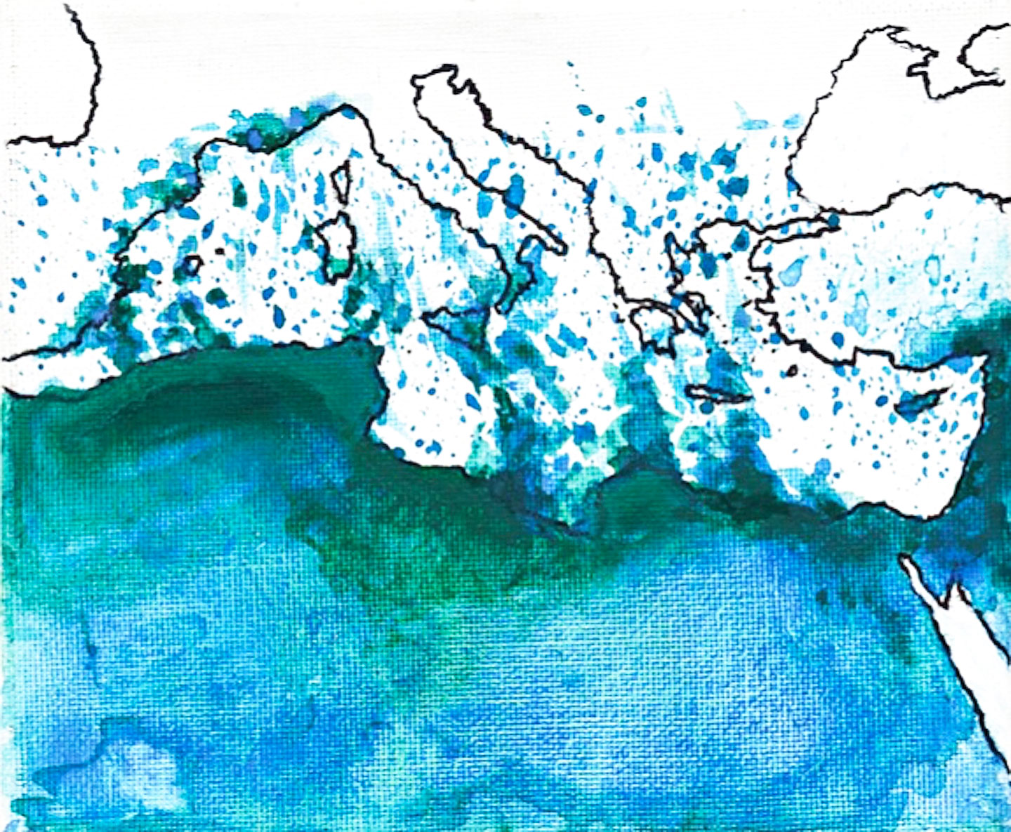
Franco Farinelli, “Il Mediterraneo, la differenza, il differimento,” Geotema 12 (1998): 57–62.

4

Paolo Giaccaria and Claudio Minca, “The Mediterranean Alternative,” Progress in Human Geography 35, no. 3 (2010): 346.

5

See .

6

Achille Mbembe, On the Postcolony (University of California Press, 2001).

7

See the photo here .

8

W. J. T. Mitchell, Seeing Through Race (Harvard University Press, 2012), 127.

9

Matej Povse in conversation with the author, December 13, 2019.

10

Judith Zijlstra and Ilse Van Liempt, “Smart(phone) Travelling: Understanding the Use and Impact of Mobile Technology on Irregular Migration Journeys,” International Journal of Migration and Border Studies 3, no. 2–3 (2017): 174–91.

11

Bram Frouws, Melissa Phillips, Ashraf Hassan, and Mirjam Twigt, “Getting to Europe the Whatsapp Way: The Use of ICT in Contemporary Mixed Migration Flows to Europe (June 2016),” Regional Mixed Migration Secretariat Briefing Paper, 2016.

12

Alexander R Galloway, Gaming: Essays on Algorithmic Culture (University of Minnesota Press, 2006).

13

Alex Sager, “Migration Crises and the Ethics of Representation,” Oxford Handbook of Migration Crises, ed. Cecilia Menjívar and Immanuel Ness (Oxford University, 2019), 592.

14

Achille Mbembe, “Necropolitics,” Public Culture 15, no. 1 (2003): 11–40. See also Mbembe, On the Postcolony.

15

Laura Lo Presti, “Terraqueous Necropolitics: Unfolding the Low-Operational, Forensic and Evocative Mapping of Mediterranean Sea Crossings in the Age of Lethal Borders,” ACME: An International Journal for Critical Geographies 18, no. 6 (2019): 1347–67.

16

Thom Davies, Arshad Isakjee, and Surindar Dhesi, “Violent Inaction: The Necropolitical Experience of Refugees in Europe,” Antipode 49, no. 5 (2017): 1263–84.

17

Dana Diminescu, “The Connected Migrant: An Epistemological Manifesto,” Social Science Information 47, no. 4 (2008): 568.

18

Maribel Casas-Cortés, Sebastian Cobarrubias, Charles Heller, and Lorenzo Pezzani, “Clashing Cartographies, Migrating Maps: The Politics of Mobility at the External Borders of E.U.rope,” ACME: An International Journal for Critical Geographies 16, no. 1 (2017): 22.

19

Paolo Cuttitta,“Inclusion and Exclusion in the Fragmented Space of the Sea: Actors, Territories and Legal Regimes between Libya and Italy,” in Contemporary Boat Migration: Data, Geopolitics and Discourses, ed. E. Burroughs and K. Williams (Rowman & Littlefield, 2018).

20

Charles Heller and Lorenzo Pezzani, “Liquid Traces: Investigating the Deaths of Migrants at the EU’s Maritime Frontier,” in Forensis: The Architecture of Public Truth, ed. E. Weizman (Sternberg Press, 2014).

21

See .

22

Thomas Nail, “Kinopolitics: Borders in Motion,” in Posthuman Ecologies: Complexity and Process After Deleuze, ed. R. Braidotti and S. Signall (Rowman & Littlefield, 2018), 184.

23

Mbembe, “Necropolitics,” 40.

24

Sherry Turkle, Evocative Objects (MIT Press, 2011), 5.

25

See .

26

On “grief activism,” see Maurice Stierl, “Contestations in Death—The Role of Grief in Migration Struggles,” Citizenship Studies 20, no. 2 (2016): 173–91.

27

Here are just a few: Exodi ; the Archive of Migrant Memories ; and a “map-archive of borders zones” created by the Faculty of Law at Oxford University .

28

David L. Eng and David Kazanjian, Loss: The Politics of Mourning (University of California Press, 2003), 3.

29

Marta Zarzycka and Bettina Papenburg, “Motion Pictures: Politics of Perception,” Discourse 35, no. 2 (2014): 164.

30

The phrase “optical unconscious” was used by Walter Benjamin in reference to photography. See Benjamin, “A Small History of Photography,” in One-Way Street (New Left Books, 1972, orig. ed. 1931), 240–57.

31

Steinberg and Peters, “Wet Ontologies,” 248.

Category
Migration & Immigration, Image, Photography, Borders & Frontiers
Subject
Water & The Sea, Necropolitics, Maps, Mediterranean, Death, Photojournalism
Return to Issue #109

Laura Lo Presti is a postdoctoral researcher in the “Landscapes of Human Mobilities” project at the University of Padua. She is also a visiting researcher in the Geo-Humanities group at the Pompeu Fabra University in Barcelona, and a member of the international research project “Mapping and the Making of Empire” at the Groningen Research Institute for the Study of Culture (ICOG). In her work, she confronts ideas, theories, and methods from cultural, feminist, and postcolonial studies, migration and border studies, visual culture, and contemporary art with the scholarship of new cultural geography and critical cartography.

Advertisement
Subscribe

e-flux announcements are emailed press releases for art exhibitions from all over the world.

Agenda delivers news from galleries, art spaces, and publications, while Criticism publishes reviews of exhibitions and books.

Architecture announcements cover current architecture and design projects, symposia, exhibitions, and publications from all over the world.

Film announcements are newsletters about screenings, film festivals, and exhibitions of moving image.

Education announces academic employment opportunities, calls for applications, symposia, publications, exhibitions, and educational programs.

Sign up to receive information about events organized by e-flux at e-flux Screening Room, Bar Laika, or elsewhere.

I have read e-flux’s privacy policy and agree that e-flux may send me announcements to the email address entered above and that my data will be processed for this purpose in accordance with e-flux’s privacy policy*

Thank you for your interest in e-flux. Check your inbox to confirm your subscription.